SRT RSS Feed

Mt. Washington, Joel Kantor Style

By Joel Kantor

There’s the old saying that a man’s gotta know his limitations. I’m still searching for mine with the exception of two — height and cold weather. I can pilot my own plane but I can’t look out a window just three stories high and after getting a minor touch of frost bite while duck hunting years ago, I don’t do well in cold weather. I won’t be climbing Mt. Everest.

“Solo” conjures thoughts of being alone. With further consideration we may agree that solo could include those times when we accomplished ‘solely’ by our own efforts. In golf while we compete against other players, all things being equal, we all press ahead alone, against the elements, those natural challenges Mother Nature puts before us and those we struggle with within each of us. And so it was for me recently when I attempted to ascend Mt Washington on February 7, 2009.

At 6288 feet, Mt. Washington is one of many peaks making up the Presidential Range of the White Mountains in north central New Hampshire. It’s one of those unusual places where the weather of the lower 48 states comes crashing together. While at any given time there may be a colder place, history has crowned Mt. Washington with the Earth’s highest surface gust at 231 mph on April 12, 1934. It’s a reminder to every climber/hiker of the ruthless and relentless environmental hurdles one must overcome to meet this challenge — much less overcome it. Believe me, 50 mph winds can be enough to nearly knock you off your feet. Add to that temperatures oscillating around (and all too often at this time of year) below zero. Top that with 50 inches of snow at the bottom of the mountain changing to smooth rime ice at the top and you discover no step is on a flat surface and no step can occur accidentally.

If you laughed and smiled through Bill Bryson’s “A Walk in the Woods” then you can appreciate the rest of my story.

If I lay on my back and you step on my stomach, I am 5’9″, coming in at 185-190 pounds with 52 years of life under my belt. I spend 9 months a year training for nothing in particular and 3 months a year feeding the tape worm left behind from the previous 9 months. My life is shared with a wife and daughter who demand little of me and enjoy the fact I have no interest in being dragged to the mall. So I work, they shop; we are both good at what we do….well they may be a tad better at their endeavor than I. Based on all this, my health ranges from an out of shape 185+ to a svelte (skinny legged) 170 pound Sherpa.

Solo Canoe Transport

Solo Canoe Transport

Each year, I find myself on some sort of outback adventure. I come from the city so the term “outback” (for my purposes) has been citified so humor me. Through the years the trips have ranged from a week of camping and canoeing in the Boundary Waters of USA/Canada to backpacking the Wind River Mountain Range in Wyoming (see your hostess sitting on a rock, holding a tasty Yellowstone cutthroat) to riding a bike hundreds of miles a week through Maine, New Hampshire, Quebec and back into Vermont and New York’s finger lakes. 2008 included one of those torturous 5 days of hill climbing each and every notch of Vermont followed by a couple days in New Hampshire climbing Bear Notch Road to the Kancamaugus Highway, west to Route 3 partially via the bikeway north, then Rt. 302 east through Crawford Notch back to Bartlett. Whew!

Coming from the flat lands of Oklahoma I am neither fast on a bike nor do my skinny legs provide much oomph up a mountain, especially one rising for miles on end. But as those who have traveled with me know, I am tenacious. Once I begin, there is no quit in me.

xoxo

Vermont State Capital. Joel on the left, Sherpa John on the right.

This past year I was in the absolute best shape ever (relative), but that did not inhibit the locals from kicking my ass up and down every hill. They found great joy in searching out the next more difficult challenge, but little did they know the free bourbon and Crockpot meals each night were worth every grinding moment up those hills.

This (in the true fashion of my windy self) finally brings me to the explanation of how the pursuit to climb Mt. Washington came about.

After one of those 8 hour rides, it was time for me to reach for the low-ball and put my feet up. There on the far wall was a picture worth more than a thousand words. It depicted a man on glass wearing a backpack. I inquired and found that it was a picture of my host Steve at the top of one of the local mountains one cloudless, full moon evening. You leave at 5:00 in the afternoon in order to be at the top by moon rise so that you can still get back before the distillery closes. I had to have one of those pictures of me; hence I was coming back in 4 months to get one.

Joel’s own photo of the moonlight climb. Okay, he didn’t summit Mt. Washington, but he saw THIS!

On Feb 5th I boarded an American flight to Boston where my [true] Sherpa cousin, John picked me up. Yep, I was 15 pounds overweight wishing like hell the Dunkin Donuts shop could be had through arrivals instead of only being on the secure side of the airport. I haven’t spent 10 hours over 4 months exercising (mistake 1). All I had with me was brand-new-very-warm-duck hunting attire (mistake 2) and my ego………a sad replacement for being prepared.

John and I spent the next day with his family but soon after, were stuffing the car for the 3 hour ride north into New Hampshire; Gilligan would be so proud. We drove directly to the outfitter where we had reserved boots and crampons. The rentals aren’t much different than the boots we rent for skiing. You know what I’m talking about? The boots that cut the blood off to the brain after you clamp down the top latch. The first pair wouldn’t even accept my foot, so I went to a size 11 – too tight (or so it seemed at the time) so I settled on a size 12 (mistake 3). From there a brief exchange between Steve and the rental place over whether we did or did not need snow shoes; they said no, Steve said yes, they said and so on. We ended up not renting them (mistake 4).

Across the street we found a perfectly good pub and the first opportunity to get a picture of the three merry men who would be rising early the next day for one of the adventures of my life. Those two other guys had no clue what they were dragging along; an old guy, completely out of shape, with little appropriate clothing, shoes too big to keep on and no snowshoes to keep me upright in the soft deep snow.

The Three Merry Men, Pre-Climb

The Three Merry Men, Pre-Climb

We awoke at 6:00 am to MINUS 4º. Saturated in adrenalin I cannot wait to scarf down the oatmeal and hit the trail. I’ve completely forgotten who Stephen Katz is and I’ve no clue what I’m about to do yet I’m positive it will be a walk in the woods. We arrive at the parking lot met by a half dozen of Steve’s outdoor buddies; Bill nearly 75, Mary the perpetual student focused on clinical psychology and the others. As I exit the car with my very cool camo on, I instantly know something is out of character. I’m the guy looking around the poker table trying to figure out who the chump is. Oh! It’s me.

“I’m the guy looking around the poker table trying to figure out who the chump is. Oh! It’s me.”

The temp has quickly risen to the low 20’s and the higher we climb, the warmer it gets; go figure. Halfway up the first leg I change clothes. The first set is soaked. Leg one is about as steep as anything I’ve climbed. I’m using every foothold I can find while avoiding the deep foot prints, but frequently I sink up to my crotch. It’s windy but the trees do a good job of blocking the harshest wind until we reach the top. Having dressed for 50 mph winds and minus 30 degrees, it’s over 30 degrees and I’m drenched to the bone with sweat but still comfortable as long as I keep moving….albeit at half the pace of the others.

We reach the first hut where the trail presents us the option; Mt. Washington to the left, Mt. Monroe to the right. Despite my desire for a cozy restaurant with a well stocked pantry, I’m fully aware we’re veering to the left. The next ¼ mile is on windblown rime ice covered rocks slanted sufficiently to encourage you to slide off the mountain. This is crampon land and I’m really moving now as the wind is pushing me from behind. I look up and my two buddies are already 100 yards ahead of me. Picking up my pace is futile; another 10 minutes and they’re ahead by another 100 yards. Steve knows now we can’t make the top and back before dark so we turn back towards Mt. Monroe.

Mt. Washington would not be summited today. The picture from the top of Mt. Monroe was worth every step. But I know I’ll be back to get my picture from the top of Mt. Washington.

I returned to the rental store the next morning and got a pair of boots that fit and some of the right clothing and with effort, made that night hike and another ascent the following morning. It’s true; we can do anything we put our minds to. While some things need to be attempted with the appropriate adult supervision, there are plenty of opportunities to be solely responsible for the results. I didn’t fail to climb Mt. Washington; I progressed.

— Joel is an avid flyfisherman, a Partner in the Pinnacle Investment Advisor’s firm, a Certified Financial Planner, and ranks 3rd in the state of Oklahoma for fund raising for the Multiple Sclerosis Society. He can be reached at [email protected].

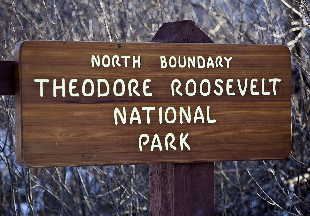
Theodore Roosevelt National Park

Medora

Theodore Roosevelt National Park

The plan from the start was to see North Dakota from end to end. Entering the state on its far western border from Highway 85 (two hours later than planned) because of the hunt for the Geographic Center of the U.S., I’m tempted to call it a day. Snowfall in the Western part of the state has been unusually heavy over the 2008-2009 winter, meaning road conditions demand attention.

But not enough to override the recognition night is about to throw its protective cover.  And with that dimming comes glorious shadows, wildlife stirrings, sunset kaleidescopes, and the overall suspense that lovely, unexpected things happen when the light wanes. Joy spreads through my tired limbs leaving no room for thoughts of the creature comforts of a motel room. I drive into T.R. National Park.

Theodore Roosevelt became the nation’s 26th President in 1901. He said “I would not have been President had it not been for my experience in North Dakota.”  The Park includes Roosevelt’s Elkhorn Ranch and was designated a National MEMORIAL Park in 1947. It didn’t achieve full National Park status until Jimmy Carter gave the approval in 1978.

IMG_1179

Mule Deer

Theodore Roosevelt National Park

See what I mean about lovely surprises?

What I Brought Back – China

To eat Nan bread,  palm the bagel-like perfection and with a quick twist of the wrist, turn the bread over to expose its underside.  Inspect for fragments of the oven wall that adhered during the baking process.  With a finger nail, rapidly fleck off this debris. From the initial palming of the bread to the last bite, the entire process is gloriously tactile indulgent.


What I Brought Back

A teapot purchased from a Silk Road flea market in Kashgar, China.

I brought the above teapot back from the 5 week backpacking trip with my son to China. The interior is flaking with the tea-rust built up from many a Chinese tea party; the exterior rubbed smooth by the hands serving it.  My son and I were browsing and eating our way through a bazaar in Kashgar when I spotted it.  My son bargained for it with not many words being said, but a lot of scribbling back and forth between me and the shop owner.  Only regret, we didn’t save the piece of paper. 

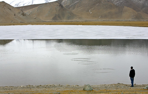
And here’s something from the China trip that could not be physically contained — John skipping rocks on Karakul Lake. 

My Son Skipping Rocks on Karakul Lake

Skipping Rocks on Karakul Lake. Xinjiang Province.

Of Rattlesnakes & The Geographic Center of the U.S.

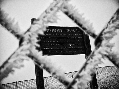
Clamoring on the steep incline under the weight of my heaviest film camera (reserved only for the most promising of discoveries), slipping twice to one knee on rime ice, I hitch one last gasp of frigid oxygen as my head lifts my eager eyes into perfect position to feast on the conquered monument. Sheepherder’s Monuments!? !*&#@%! “This is NOT the Geographic Center of the United States of America??!!” My lips are too numb to spew anything out, but my mind handles it beautifully in their stead. “I climbed all this way, alone in the middle of Greenland, South Dakota for THIS!?” Kicking the fence while hanging on with one gloved hand to steady my footing, the shards of ice and frozen atmosphere target the only opening to my skin, right down the back of my neck. And if there’s any justice, hopefully into the dens of a few sleeping rattlesnakes.

“Sheepherder’s Monuments or stone Johnnies survive the days of the open range. These stone columns were probably built to indicate distance and direction to waterholes and provided the sheepherder with a pastime while herding his flocks.”

The Geographic Center of the U.S. is not where you’d expect. Furthermore, it’s not where my 2004 Atlas said it would be. After spending an hour-and-a-half combing the area, I know. North of Belle Fourche (Bell Foosh), South Dakota on Highway 85, just South of Junction 168, my Atlas in bright red said: “Geographic Center of U.S. Marker”.

From setting my sights on a grandiose solo road trip self-portrait at the geographic center of the United States of America, the search dwindled to looking for something as tell-tell as a unique T-Post in the frozen fence line. Incredulous the grandiose was not forthcoming, I became desperate to find something and perplexed as to what could have happened to a marker of such importance. Blood pressure increasing, my eyes landed on the remnants of an old paved road. No gates, no signs, with just enough pavement and old footings to indicate something of note stood here at one point, I excitedly drove around the site to get my bearings. Perched above the disintegrating pavement and towering above the prairie was an area surrounded by a menacing fence. Without question this was something the Department of Interior had gone to great lengths to protect — I’d discovered it after all.

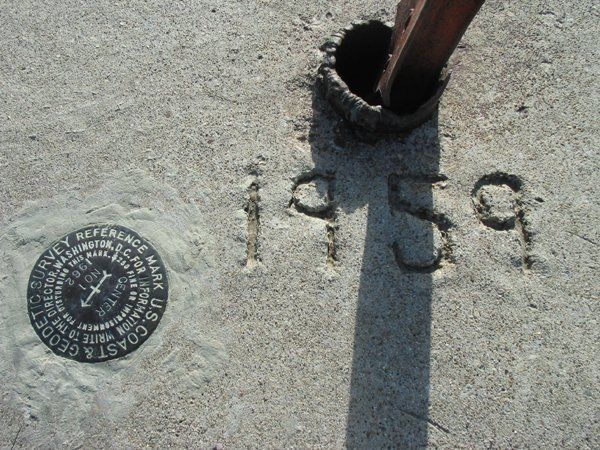
Confused? So was I. So here’s my best shot at an explanation. But I warn you, there’s not a lot of authoritative research to rely on and a lot of what follows is disputable. In 1959 the U.S. Coast and Geodetic Survey officially designated a point 13 miles north of Belle Fourche, South Dakota as the Geographic Center of the U.S. (which includes Alaska and Hawaii). The location was surveyed at: Latitude 44 degrees, 58 minutes North, and Longitude 103 degrees, 46 minutes West.  Any marker grander than the requisite USGS benchmark in the ground was up to the state of South Dakota to provide and maintain. Around the same time, maybe AT the same time, the Department of Interior built the Monument marker and fence (since it’s on Bureau of Land Management land) for the nearby high-plains cairns of Sheepherder’s Monuments. The State of South Dakota then proceeded to build a picnic area, restrooms, etc. on the site and sold tickets billed for seeing both monuments. Recall previously I mentioned the footings for buildings and the video shows restrooms.

The rattle snakes must have felt they weren’t being cut their fair share and laid claim to the area. Either the Department of Interior, the state of South Dakota or both, closed and abandoned the Sheepherder’s Monuments’ area in the mid-1990’s.  Solo road trippers, caution is ALWAYS justified and should NEVER be disparaged. What you don’t know can kill you. There were no signs warning of rattlesnakes. Had I gone in any of the 3 other seasons of the year…well, I was wearing hiking boots. Given that I’m here to tell this tale, I learned a lesson and should I be faced with such a situation again, I will recall this hell-bent mission to see something and hopefully make a good decision.

Eventually the Belle Fourche Chamber of Commerce approached the National Geodetic Survey with a plan to build a new concrete and granite marker IN the town of Belle Fourche making it easier to share the marker with the world. The National Geodetic Survey agreed to the new location and contributed the stainless steel centerpiece of the monument. It was unveiled in 2007.

The original marker STILL LIES 13 miles North of Belle Fourche off highway 85 on someone’s fence row, seldom visible, and is but a footnote in history, if that.  It’s the marker I want to see.

The official bronze mark made in 1959

The original USGS benchmark made in 1959 — NOT my photo.

Of Rattlesnakes & The Geographic Center of the U.S.

From the top of Sheepherder’s Monuments. While not locating the Geographic Center of the U.S. marker, seeing Sheepherder’s Monuments, in retrospect turned out to be a very exciting find. I’m glad I made the trek.

Take a Solo Road Trip!

We’re a nation teetering on social burn-out. The multitude of devices designed to bind us together like links in a chain has made it difficult to go to the bathroom and be alone. Articles on efficiency are prolific: how to cut a minute off some task, make your morning shower more efficient, and speed up this or that. And yet I know more discontented people than ever. When the pundits start messing with your morning shower, who wouldn’t be unhappy? It all begs the point, if being continually connected to a large group of people and having your life maximized for efficiency can’t deliver happiness, what’s missing? Some solo time my friends.

Water Drop

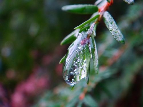
Liquid Light

Ester Schaler Buchholz, PhD, an outspoken advocate for solitude, in her 1997 book The Call of Solitude writes: “We live in a society that worships independence yet deeply fears alienation. The earth’s population has doubled since the 1950s and in cities across the world, urban crowding and the new global economy have revolutionized social relationships. Cellular phones now extend the domain of the workplace into every part of our lives; religion no longer provides a place for quiet retreat but instead offers “megachurches” of social and secular amusement; and climbers on top of Mt. McKinley whip out hand-held radios to call home. We are heading toward a time when, according to the New York Times,” portable phones, pagers, and data transmission devices of every sort will keep us terminally in touch.” Yet in another more profound way, we are terminally out of touch. The need for genuine and constructive aloneness has gotten utterly lost, and in the process, so have we.”

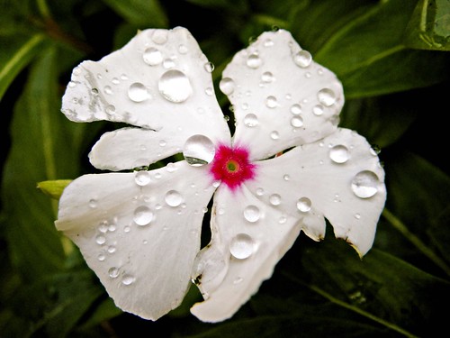
More than Dew

Solo road trips (SRT) strike fear in the heart of many. Either the brain conjures up “solitary confinement” and goes downhill from there or the thought of a road trip disgorges memories of the family sedan and their Dad’s mission to see America at 55 mph. But it’s not about getting away, it’s about going somewhere….with yourself. I read an article on solo travel that recommended spending some time on a psychological sofa before heading out on a solo road trip. I beg to differ. The trip IS the psychological sofa. And there’s no astronomical hourly billing attached. Few things in our lives are as liberating, empowering, and rejuvenating as a solo road trip. Yet as good as that sounds, most people have NEVER taken one. Friends can face down a room of professionals in a board room, or the crush of orders coming in for burgers and fries at high noon, but they can’t face the prospect of being alone.

Let’s debunk a myth right off the bat about solo travel. There are those who believe the only experiences that really matter are those you share with someone else. Pifel! That’s my mother’s favorite exclamatory word and provides a more politically correct substitute for my favorite words: bullshit, crap, crapola, and whatacrock. If you asked these people in a question format “do you believe the only experiences that really matter are….” they would likely say “no.” But my SRTs have become a curiosity, and with that I’ve become a curiosity. So I hear feedback about them and I can tell you a lot of it is negative and without any ability to relate. Why? Because deep down they believe the myth and they can’t relate to those of us who don’t. Various friends and family members are so unable to relate to my road trips, they can’t talk about them. Upon my return last fall from 9 days on the open road, a best friend called and said “Okay, it’s just not right you wanting to have all that fun to yourself, and I demand to go with you on the next one.” Judy. Then it wouldn’t be a SOLO road trip. The concept is beyond her; fun should be shared. End of discussion. But it’s not the end. If it were, I’d have nothing else to write. And I’ve plenty to say, so stay tuned.

pink plate

Join the Road Trip Revolution at the Solo Road Trip Facebook Fan Page, here.


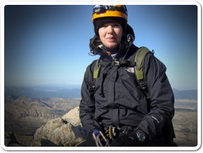
The Grand Climb


Tammie DooleyAbout SRT... I’m a traveler, writer and photographer for whom the open road frequently summons. Adventurous solo road trips are a staple for me, and a curiosity. So I created this website to share them and inspire you to step out and give them a try. Welcome!

A soul that sees beauty may sometimes walk alone – Wolfgang Von Goethe

  • Categories


  •  

    Connect with SRT

    RSS Connect on Twitter Subscribe by Email
    Email me
    Become a SRT Facebook Fan
    Follow me on Twitter
    See my photos on Flickr

    I want to hear from you!
    ~ Tammie


    World Reviewer adventure travel blogs