SRT RSS Feed

The 5 Gateway Towns to Yellowstone National Park

Despite the general Western flavor of the towns that give residency to Yellowstone National Park’s gateways, before 1890 these five towns would have appeared an inconsonant mishmash of patched together backwoods watering holes.  But Yellowstone National Park, as vast and varied and tumultuous as it is, leaves no room for discord.

Like an army on a battlefield made cohesive by the power of a common cause, everything within its vast caldera and expansive rim has been pulled together, however begrudgingly, by the same forces of nature that once blew it apart. All those stray, eccentric pieces are now part of the YNP common denominator. But Yellowstone’s gateways are the Old West and the old west, still true to its hard fought infamy, continues to kick common denominators to the ever dusty curb.

Among the who’s who of western towns, Yellowstone National Park’s gateway towns embody our romanticized daydreams of the Old West. In other words they have an element of kitsch.  But it’s so guileless and enthusiastically presented that our expectations for an old west experience, however kitschy, are exceeded by the same leap the Colt revolver made over the bow and arrow.  We become immersed voyeurs to the old west ways, loving every moment of it. 

Small treasures offering inimitable charm and scenery, abundant wildlife, and a broad range of alternatives capable of meeting everyone’s entertainment needs, these towns will not disappoint.

Kitsch:  “Sentimentally charming, tacky and fun all rolled up in one. One catch with kitsch is that you’re never quite sure if it’s supposed to be serious or not. It’s that uncertainty that is amusing. Kitsch is melodramatic, overdone, gaudy and tacky or sentimental and folksy. It’s so bad that it’s cool.”  Yes, please. 

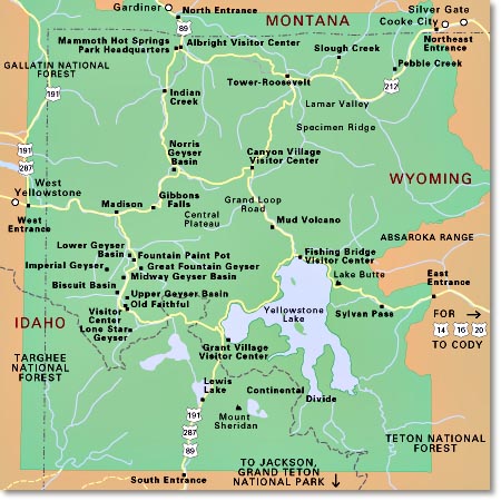
Map of the 5 Yellowstone entrances

Map of the 5 Yellowstone Entrances

** Exploring Yellowstone’s entrances and the towns anchoring them, takes homework.  The North Gate entrance in Gardiner, Montana is the only entrance that’s fully accessible and open year-round.  

West Yellowstone, Montana: West Gate Entrance

In 1905, E.H. Harriman, president of the Union Pacific Railroad, and Frank J. Haynes, president of Monida & Yellowstone Stage Line met in the area of West Yellowstone for a tour of the Park. Afterwards, Harriman constructed a railroad branch from St. Anthony, Idaho to the west entrance of the national park. By December 1907 the tracks were laid and when the snow pack melted, the first tourists made their way to the Park through this entrance in June 1908. Each summer, the “Yellowstone Special” train made trips daily from Salt Lake City to West Yellowstone. West Yellowstone developed around this flow of tourists.  For reference, park tourists had already begun entering the North Gate from Gardiner, Montana in 1903. 

When you get to West Yellowstone, park the car.  The town is compact and meandering friendly.  

Not To Be Missed — Strolling, huckleberry ice cream, the Union Depot Dining Hall, and the Yellowstone Historic Center Museum.

West Yellowstone airport (WYS) is open to commercial flights (Delta) from June 1 – September 30. 

For 2019, this entrance opens April 19. 


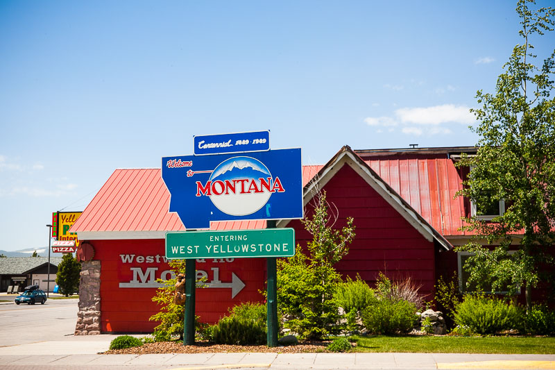
sign for entering West Yellowstone, Montana

Fun Times Ahead


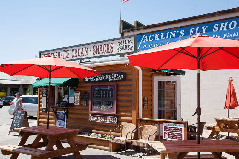
sign for huckleberry ice cream

Snacks and Kitsch


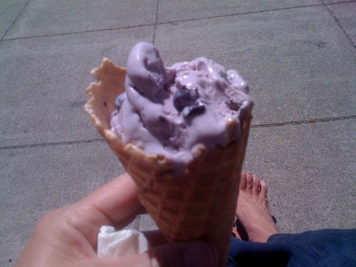
a cone of huckleberry ice cream

Out of Focus Huckleberry Ice Cream, In Focus Bare Feet


Jackson, Wyoming:  South Gate Entrance 

It’s easy to believe you’ve reached Yellowstone National Park when you haven’t — you’re still in Grand Teton National Park. Beauty begets beauty so the confusion is understandable. Grand Teton National Park begins about five miles north of Jackson on 191/89. The physical entrance gates to Grand Teton National Park are at Moose Junction, 12 miles north, and/or Moran Junction, about 30 miles north of Jackson.  The south entrance of Yellowstone National Park is about 50 miles north of Jackson on 191 (for reference, Old Faithful is approximately 40 miles further).  

Since we’re talking about Jackson in the context of Yellowstone’s South Entrance, in the fall (my favorite time of year there), you may be able to drive a distance towards Yellowstone from Jackson, but that entrance closes in October.  This area can see snowfall in the range of 300 inches over the winter season.  Which means if you don’t do your homework and you wind up in Jackson desiring to drive to Yellowstone after the entrance closes, you’ll have to drive west into Idaho, then north into Montana, east to Livingston (yep, all the way to Highway 90) and finally, south to Gardiner (the West entrance is closed for the winter as well so don’t go knocking on that door). Gardiner, Montana is home to the North Gate and the only Yellowstone entrance that’s open year-round.  Do your homework. The trip is about 200 miles of brutal driving. In other words, throw a kiss at Yellowstone because you won’t be seeing it until spring. One qualification, you can enter the South entrance with a snowmobile.  

Jackson Hole’s airport (JAC) is open year round to commercial flights, typically Delta, United and Skywest, with occasional/seasonal flights available from American.

For 2019, this entrance opens May 10 and generally closes in October. 

50 Things To Do in Jackson Hole and Grand Teton National Park


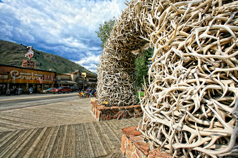
antler arches Jackson Hole Town Square

Antler Arches Jackson Town Square


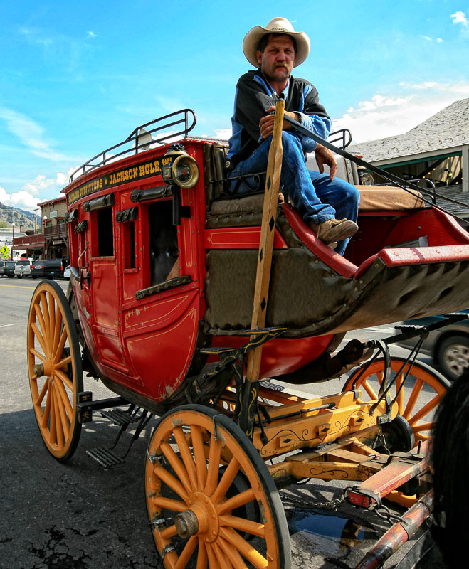
stagecoach driver

Jackson Hole Stagecoach


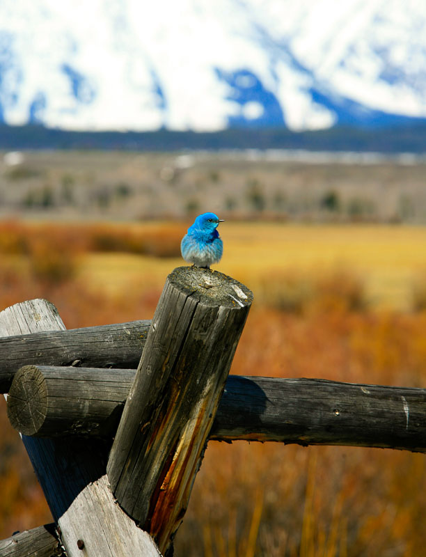
western bluebird on a post at the base of the Tetons

Western Bluebird


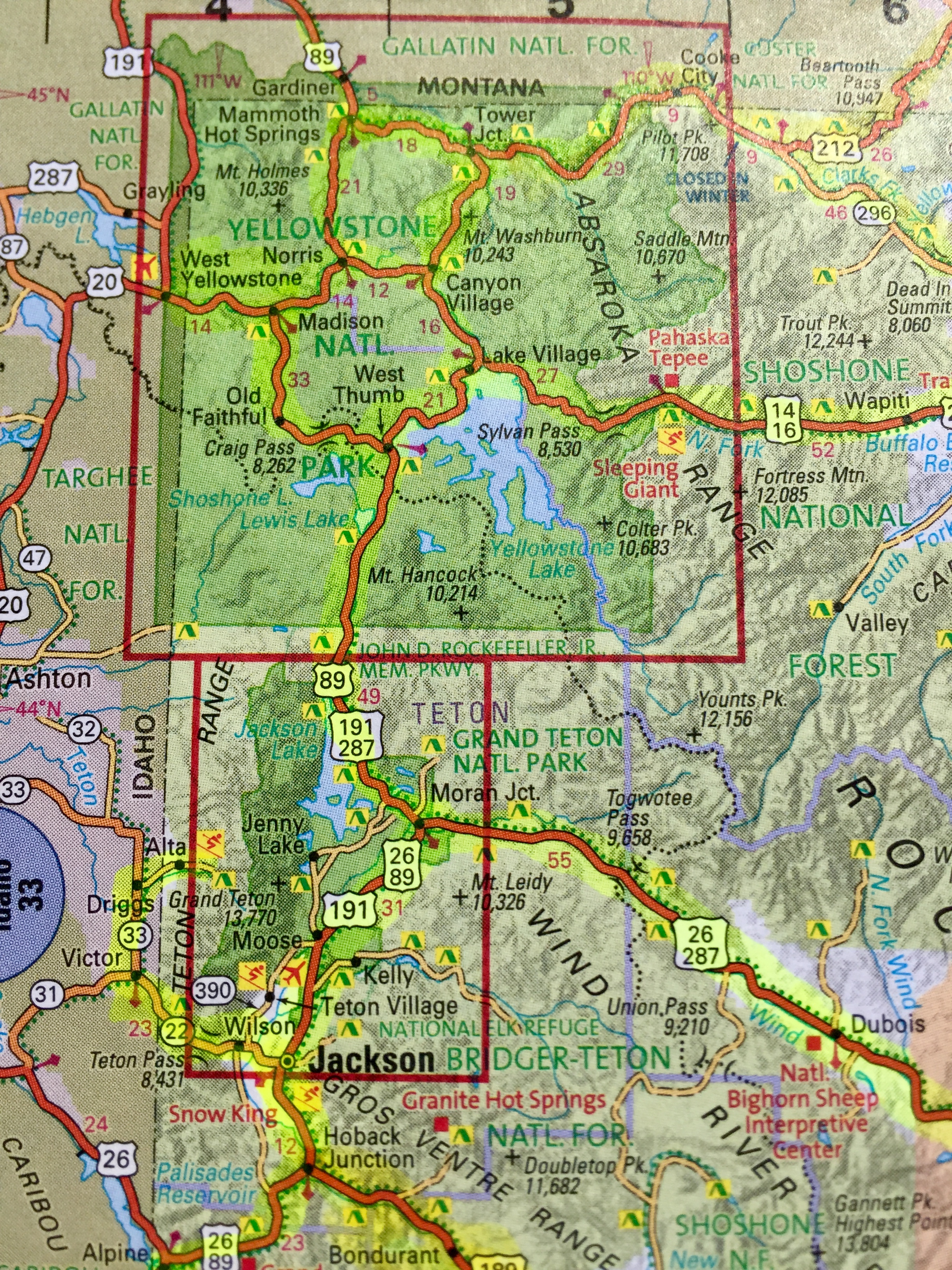
atlas view map of Jackson Hole and Yellowstone area

Map of Jackson Hole & Yellowstone are

Cody, Wyoming: East Gate Entrance 

Cody’s offerings pivot around its progenitor Buffalo Bill Cody.  Which means one thing – you’re in for a show. Buffalo Bill’s Wild West Show ran for 30 years, making him the most famous entertainer in the world in the early 1900s.  Set aside plenty of time for your  52 mile drive from Cody to Yellowstone National Park.  President Theodore Roosevelt called it “the 50 most scenic miles in the world.”

Yellowstone Regional Airport in Cody serves the entire area with commuter flights offered by major carriers year-round from Denver, Colorado and Salt Lake City, Utah.

For 2019, this entrance opens May 3.

Buffalo Bill Historical Center

Cody Nite Rodeo

The Irma Hotel

Buffalo Bill State Park / Reservoir


snow covered mountains on road from Cody to Yellowstone

Road From Cody to Yellowstone


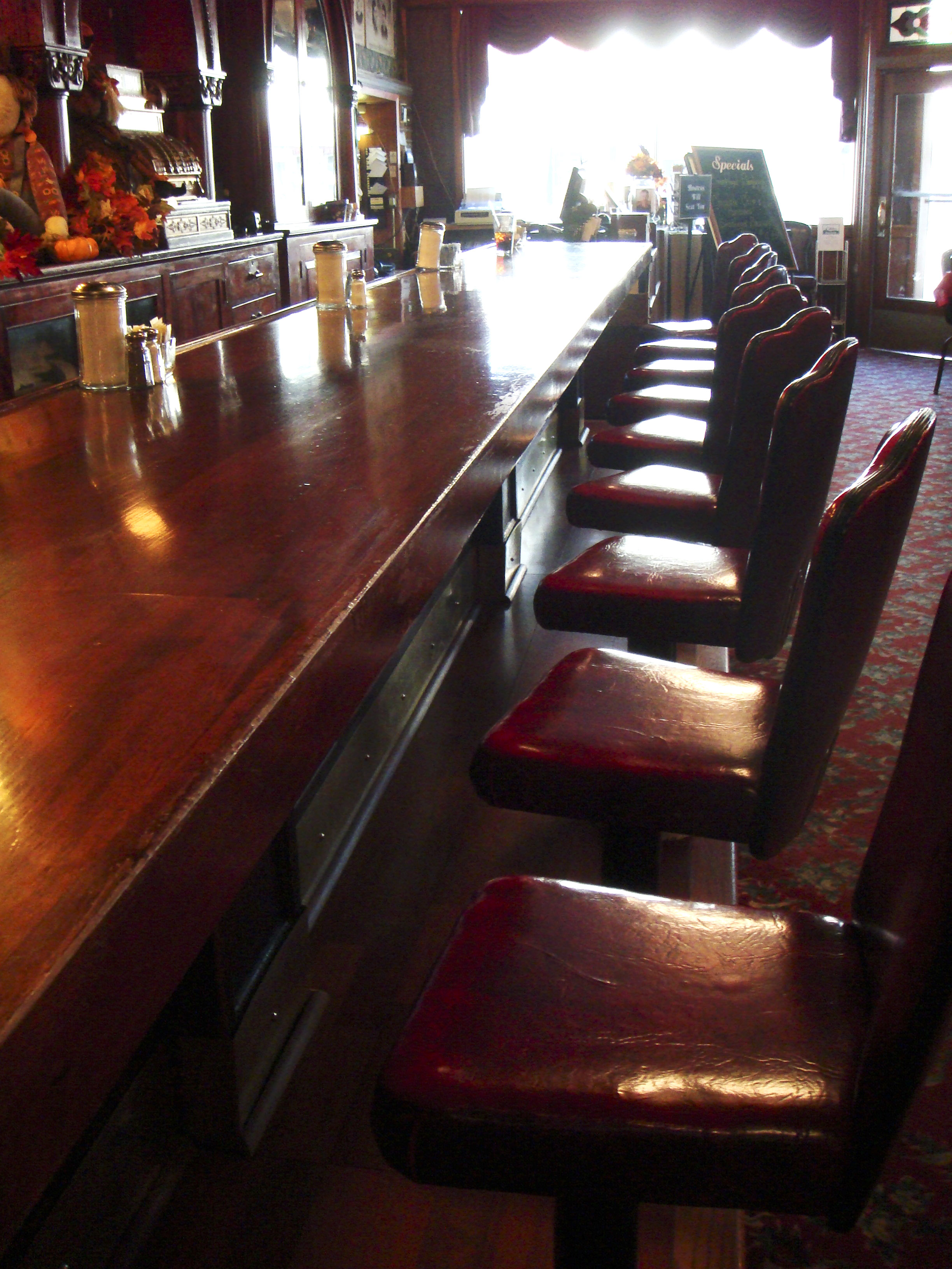
the bar at the Irma Hotel in Cody

Irma Hotel Bar, Cody


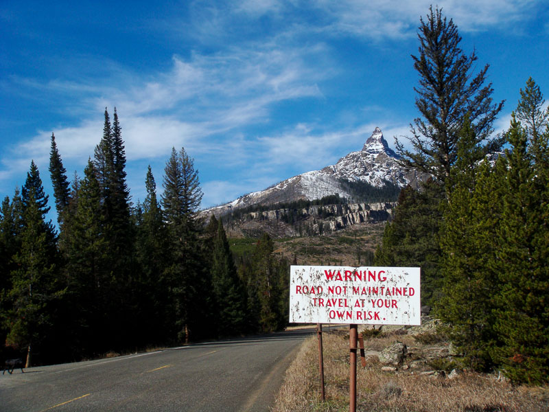
sign for Chief Joseph Scenic Highway

Highway 296 between Cody, Wyoming and Cooke City, Montana

Cooke City, Montana: Northeast Gate Entrance

For so little infrastructure, I’ve a lot to say about this Yellowstone gateway. Cooke City, Montana has done with its remote birthright what it could. First mining, then Yellowstone National Park. Originally named Shoo-Fly, the mining town was renamed in 1880 in an attempt to flatter a Northern Pacific Railroad executive into putting a stop there (apparently Shoo-Fly struck even the 1880 sensibilities as uncultured, and they dreamily desired to live in a city). In 1877 this country helped hide the Nez Perce Chief Joseph and his 800 or so band of hold-outs from General Howard’s 2,000 strong Cavalry for three months. Railroads don’t go where outnumbered bands of undersupplied men on horseback can elude the United States army for months.

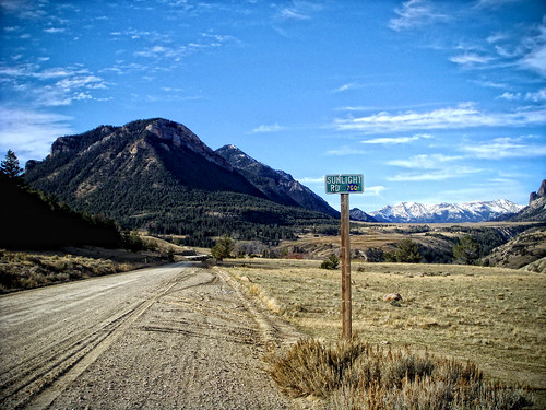
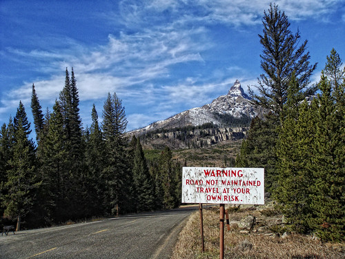
I can see why the townspeople wanted a railroad in there.  Getting to Cooke City is a gutsy endeavor.  Highways 296 and 212 merge into a single road and from that junction the town is another 14 miles of nothing but bravery. And that’s assuming you’ve got any left.  Coming out of Red Lodge, Montana on 212, BearTooth Pass at 10,974 ft. fiercely protects this route.  Coming out of Cody, Wyoming on 296, Dead Indian Pass at 8,066 feet on the Chief Joseph Highway with views of the Absaroka’s Pilot and Index Peaks (11,708 & 11,313 feet) guards the other. Pretty sure the railroad executive never made it to the town hall meeting. 

Cooke City has a year-round population approximating 100. Three hundred cavort on the one paved street in the summer months of July and August. Even though it’s considered Yellowstone’s Northeast entrance gateway community, Silver Gate, a few miles past Cooke City, actually claims the ranger station.

Take note, if you’ve not entered the Park through this least-traveled gate, this small community and the drive to get there, epitomize Yellowstone’s wildness.

The Northeast Entrance remains open year round but that’s a mere technicality.  Since the Beartooth Highway (212) closes in September/October, you can only access the gate and Cooke City from within the park.  Tricky. 


Index Peak in the Asbsaroka Mountains

Pilot Peak, Absaroka Mountains


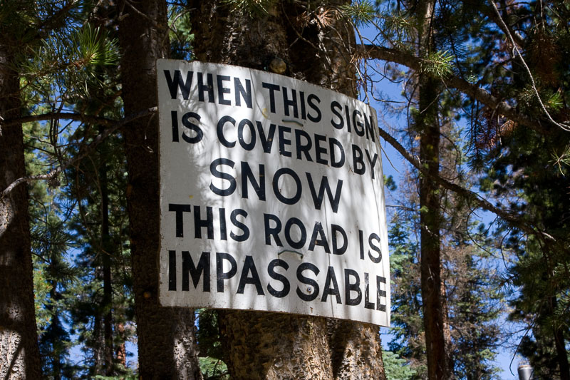
sign on the tree indicating snow levels

Snow Country’s Obvious Signs


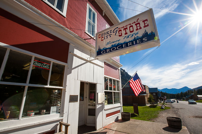
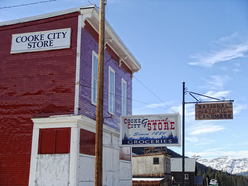
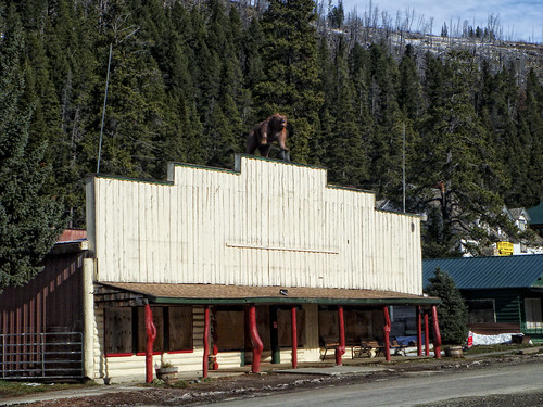
historical stop, the general store in Cooke City Montana

Cooke City, Montana General Store


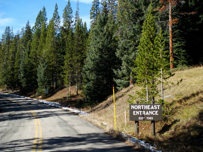
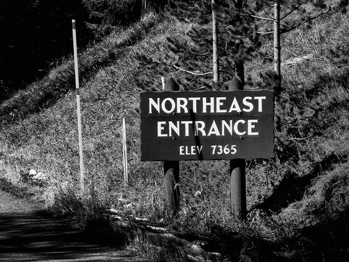
northeast entrance sign Yellowstone National Park

Northeast Entrance Yellowstone National Park


Gardiner, Montana: North Gate Entrance (the original gateway into YNP)

In 1872 when President Ulysses S Grant declared Yellowstone the nation’s first national park, Gardiner, Montana, 100 miles as the crow flies from what would become the park’s darling South entrance, was the only threshold.  Home to one of the oldest roads in Yellowstone, the Old Gardiner Road was used to ferry visitors into Mammoth Hot Springs from the Northern Pacific Railroad depot in Cinnabar, Montana. The original host to Yellowstone’s first visitors established as a 1880s stagecoach route, it’s still unpaved, and one of the few roads in the park that excludes RVs. 

President Chester A Arthur was the first U.S. president to visit Yellowstone. In 1883, he and his party led by General Sheridan, rode on horseback over the Old Gardiner Road to the park headquarters at Mammoth Hot Springs (Mammoth Hot Springs still reigns as Park headquarters).  

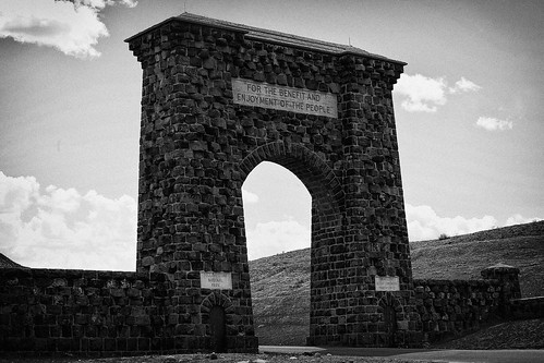
The Roosevelt Arch was dedicated by President Theodore Roosevelt on April 24, 1903. 

The Gardiner entrance remains the only entrance that’s open year-round.

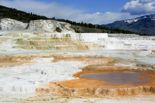
Fort Yellowstone and the beautiful travertine terraces of Mammoth Hot Springs are just beyond this gate. 
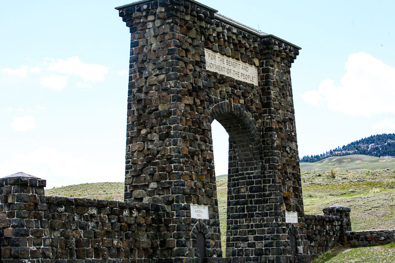
 

the large stone entrance to Yellowstone in Gardner, Montana

Yellowstone’s North Entrance; Gardner, Montana. The Roosevelt arch was dedicated by President Theodore Roosevelt on April 24, 1903.


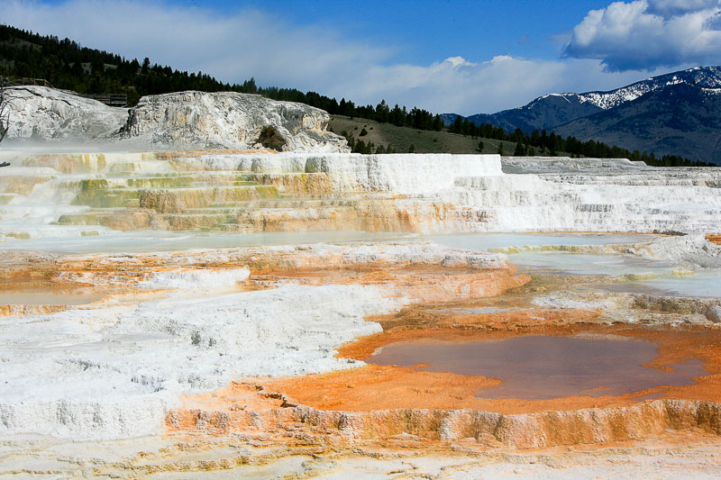
travertine terraces at Mammoth Hot Springs

Travertine Terraces, Mammoth Hot Springs


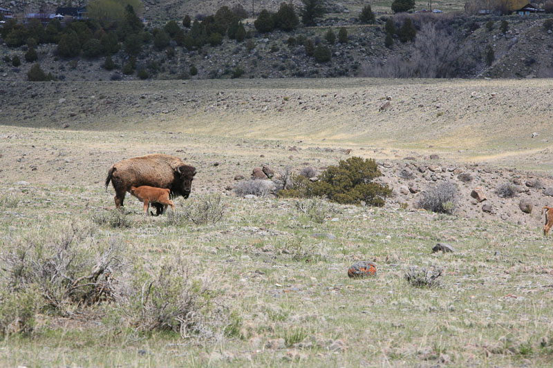
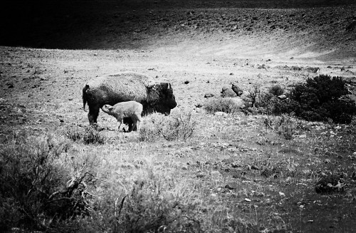
baby buffalo with mother at Yellowstone's North Entrance

Spring at Yellowstone’s North Entrance


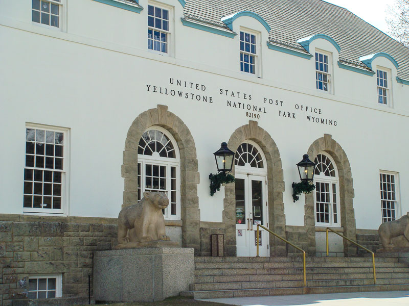
US post office Yellowstone National Park

Yellowstone Main Post Office, Mammoth Hot Springs


Join the Road Trip Revolution at the Solo Road Trip Facebook Fan Page, here.


The Black Hills: 25 Memorable Sights

This Great American Drive will compel you to sing the Stars & Stripes and purchase a long, black duster.  Be prepared.

The Black Hills (Pahá Sápa in Lakota) are an isolated mountain range rising from the Great Plains of North America in western South Dakota. The range extends into Wyoming.  The hills are covered in trees, an effect that gives them a darkened appearance from a distance. The dusky corner was distinctive enough to garner the name “black hills.”

The grandeur of granite rising from the cliffs of Mt. Rushmore will in one upward glance sweep away any countryman’s negative sentiments. And impress the hell out of everyone else.  Mt. Rushmore is but one impressive sight however, among the many packed into South Dakota’s southwestern corner.

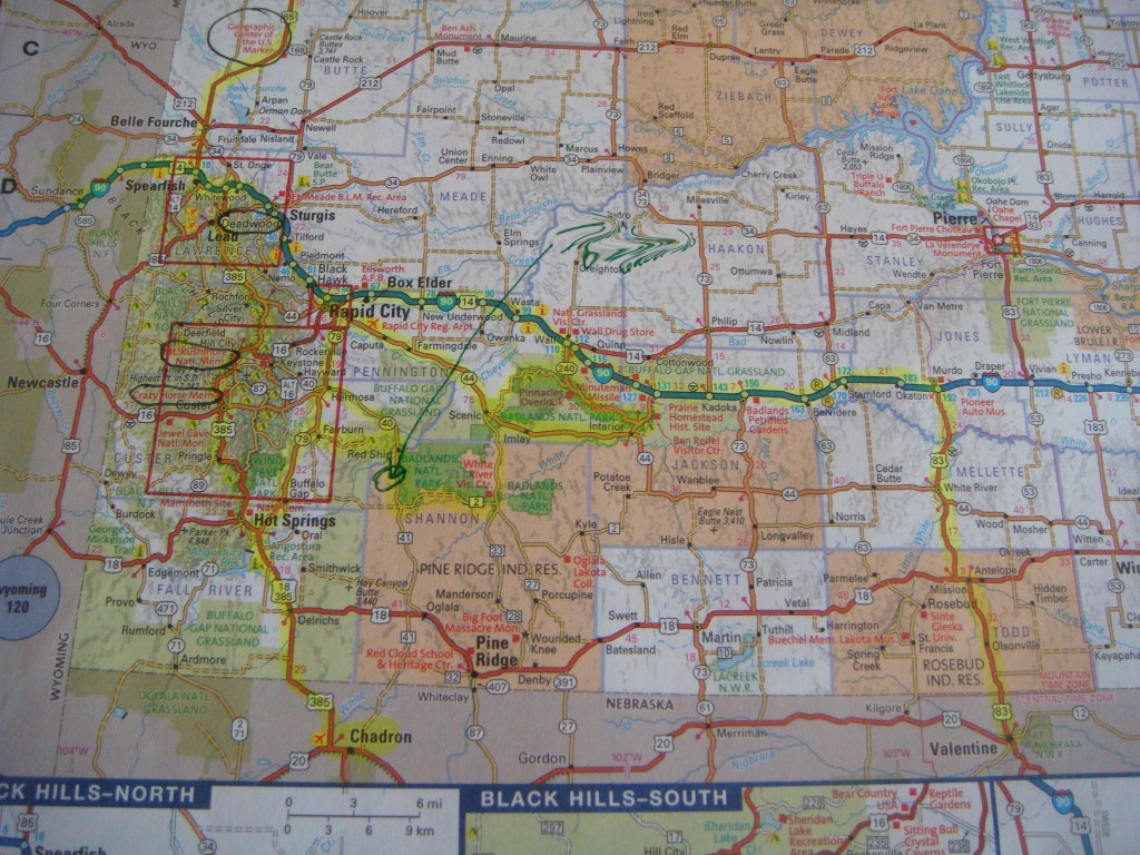
map of Black Hills South Dakota

Atlas Map of the Black Hills Area


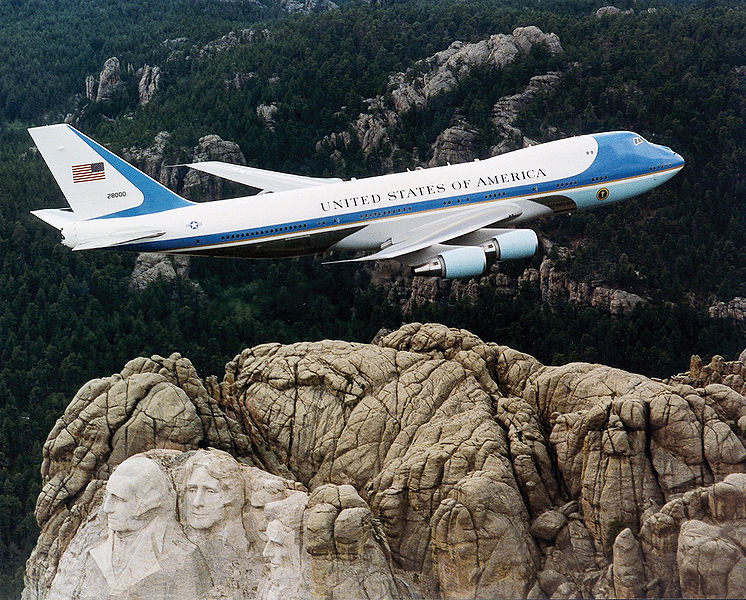
Air Force One over Mt. Rushmore. Wikimedia Creative Commons.

Air Force One over Mt. Rushmore. Wikimedia Creative Commons.


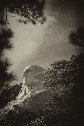
George Washington, Mt Rushmore

George Washington, Mt Rushmore


The Black Hills

Anchored by Rapid City (airport code RAP), the Black Hills area still echoes with the report of Wild West Colt pistols. You can wander through Native American Indian Reservations as you contemplate what to take in first — the sights of Mt. Rushmore featured on the big screen in National Treasure: Book of Secrets, the cavernous limestone formations of Badlands National Park, Sturgis or the frontier town of Deadwood. Throw in the Crazy Horse MemorialCuster State ParkWind Cave National Park, the 1880 TrainBuffalo Gap National Grassland, the Geographic Center of the U.S., the Minuteman Missile National Historic Site, Jewel Cave National Monument, or the Mammoth Site, and a week’s vacation can be easily spent in one of the most scenic and pivotal historic areas of the lower 48 states. And that’s before you even cross into Wyoming.

Forget the guidebook, you’ll need only your Atlas and a penchant for discovery.


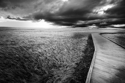
boardwalk in the Badlands

Badlands, South Dakota — Tammie Dooley all rights reserved.

The Route: starting in Rapid City

Interstate 90 East of Rapid City will deliver you to Wall, South Dakota. If you’re already parched or ready for a stop, the Wall Drug Store offers refreshment, take in the National Grasslands Visitor Center, or search for the Minuteman Missile Silo.  From there 240 South will take you directly to the scenic drive around the North Unit of Badlands National Park. The loop ends at Interior. To continue into the South Unit’s 2.7 million acres of sprawling erosion of the Pine Ridge Indian Reservation, proceed past Imlay to Scenic, turning South at the first/only turnoff. You’ll need to stop at the White River Visitor Center to get permission to proceed into the Reservation. West on Highway 2, then North on Highway 40 to Redshirt will complete the South Unit.

“Highway” 2 is a misnomer. The road is gravel, albeit wide and well maintained. Continuing past Redshirt on Highway 40 to Hermosa presents the choice of turning North on Highway 79 and back to Rapid City, or west on Highway 36 to 87 South to Custer State Park and Wind Cave National Park. From Wind Cave National Park you can easily hit 385 North taking you to Custer, the Crazy Horse Memorial, Mt. Rushmore, and the ‘1880 Train’ in Hill, as you progress northward.

Pine Ridge Indian Reservation

Pine Ridge Indian Reservation

Plains Indian Burial Platform

The area is deceptively compact.  While distances aren’t great between any point (from Rapid City to Hot Springs on 79 is only 57 miles) you will not desire to cover any of it quickly.  And the twists and turns of the roads preclude speed.  While limited lodging is available in the smaller towns and in Badlands National Park, the high season summer months make day trips to and from your pre-reserved lodging in centrally located Rapid City conducive to combing the area.

Deadwood

Once you’ve exhausted the sights south of Rapid City, 385 will take you to Lead (as in lead a horse to water), Deadwood, the Geographic Center of the U.S. in Belle Fourche, and Sturgis to the East just off Highway 90.  Either of these towns is worthy of securing lodging if you’re ready to venture past the Rapid City anchor.  Summer is high season and Sturgis, along with towns in the area are choked with bikers for the annual Bike Week Rally the first week in August.

Deadwood is a personal favorite (fall only, please). Wild Bill and Calamity Jane are buried in the Mt. Moriah cemetery. Saloon 10 is where Wild Bill made famous the Dead Man’s poker hand of Aces & Eights when shot from behind by Jack McCall (hanged for his crime). The town, while a haven for gambling is replete with history and the nostalgic charm of false storefronts.

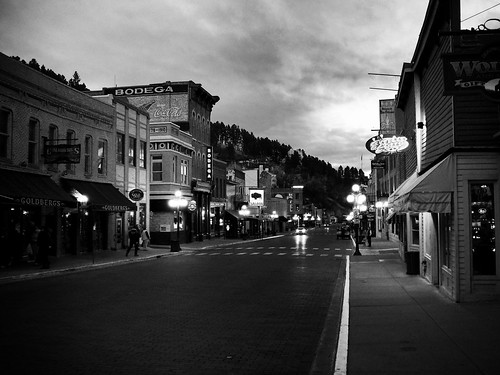
Main Street, Deadwood, South Dakota

Deadwood, South Dakota

Regarding FOOD, if you’ve got a nose for chocolate on the road, stop by The Chubby Chipmunk for a fix. 

For lunch, try Maverick’s. For dinner, Legends Steakhouse in the Franklin Hotel.  While gaming seems to be steady, the restaurants in Deadwood have turnover.  I’ve not eaten at either of these establishments, but Tripadvisor has both of these at the top of the list. Sadly, my favorites have closed since the last time I was in the area.  

A Wyoming Detour: Devil’s Tower

Since you’re on the border and you could add another state-notch to your holster belt, why not venture into Wyoming? Devil’s Tower National Monument is a quick drive and well worth the time. Take Highway 90 to Sundance, Wyoming. From there head north on 14 for a few miles. Or if you’re sticking to the backroads, Highway 34 west out of Belle Fourche (turns into 24 at the Wyoming border) will get you there as well.  Should you venture here during the off-season, don’t count on lodging nearby. There IS lodging, but…

Devil's Tower National Monument, Wyoming

Devil’s Tower, Wyoming

President Theodore Roosevelt Proclaimed Devil’s Tower the first National Monument in 1906. Many Plains Indians have legends associated with “Bear’s Lodge” and consider it a sacred site. The Kiowas legend is that several families were camped by a stream where there were lots of bears. Seven little girls were playing away from their village and bears took chase. The girls ran and just as the bears were about to catch them, they jumped on a low rock. One of the girls began to pray. The rock began to push itself out of the ground raising the children higher and higher. The bears clawing their way to the top made the deep grooves. The rock continued to push the children upward into the sky so far they reside in the sky today as the pleiades star cluster.


WARNING: If you decide to venture out of Belle Fourche to locate the original Geographic Center of the U.S. or anywhere in the above discussed areas, BEWARE of Rattlesnakes.

Join the Road Trip Revolution at the Solo Road Trip Facebook Fan Page, here.
 

Yellowstone’s Chimeric End of the Road

An ad infinitum judgment of isolation is pinned to the town by the immutable saw-toothed ridges of the Absaroka and Beartooth Mountain ranges. As I step outside the truck to see the town from the proper height, the eclipse from a large tree envelops me in its satiny cold field.  A puff of wind pushes strands of hair into chapstick. Clawing to locate and extract them, I step from the shadow into the light. Cars stowed on concrete porches, lower story windows boarded against a late afternoon sky alternating between aureate October lightness and winter gloom shedding snow like a strip tease, make for an ambiguous sense of place.

Lamps in upper story windows toss beacons of welcome. But the one sound – sips and sighs of intact blankets of smoke hanging above each chimney as they’re forced to separate and dissipate, arrests any notion of coziness. Make no mistake, winter here is serious and it’ll not stand for an outsider’s romanticized projection of it upon a town it’s preparing to overtake. It stamps the ground with a suffocating updraft; a demand for respect.

No faces have shown themselves and as I begin in earnest to discover one, I wonder if the 2nd coming hasn’t occurred during my drive from Cody, Wyoming leaving me the only hapless soul in town. There is but one road into Cooke City, Montana from the outside world.  The wildness of Yellowstone’s Super Caldera lies on the other side. This is the end of the road. As I glance over a shoulder to see my exit darkening, I feel simultaneously favored and cursed by the chimerical scene before me.

DSC03025 copy

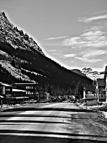
Cooke City, Montana

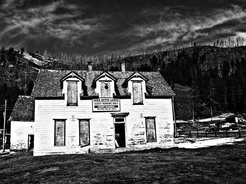
I consider the effort to clamor into the Cooke City General Store for food (do boarded windows have adequate finger/footholds?) and try to imagine the eventuality of being eye level with 2nd story windows, elevated there by a platform of snow. Like lying on your back, head dangling from the edge of a bed while pretending the floor is the ceiling, the ceiling the floor, it’s a strangely appealing, altered perspective.

DSC03031 copy

Cooke City, Montana has done with its remote birthright what it could. First mining, then Yellowstone National Park. Originally named Shoo-Fly, the mining town was renamed in 1880 in an attempt to flatter a Northern Pacific Railroad executive into putting a stop there. Coming over BearTooth Pass at 10,974 feet on Highway 212 out of Red Lodge, Montana or Dead Indian Pass, 8,066 feet on the Chief Joseph Highway out of Cody with views of the Absaroka’s Pilot and Index Peaks (11,708 & 11,313 feet)  should have given the townspeople clues as to the outcome of their flattery – no way, no how. In 1877 this country helped hide the Nez Perce Chief Joseph and his 800 or so band of hold-outs from General Howard’s 2,000 strong Cavalry for three months. Railroads don’t go where outnumbered bands of undersupplied men on horseback can elude a United States army for months.

Cooke City has a year-round population approximating 100. Three hundred cavort on the one paved street in the summer months of July and August. Even though it’s considered Yellowstone’s Northeast entrance gateway community, Silver Gate, a few miles past Cooke City, actually claims the ranger station.

Take note, if you’ve not entered the Park through this least-traveled entrance, you’re missing a lot more than a momentary gut-check about the 2nd coming. This small community and the drive to get there, epitomize Yellowstone’s wildness.

DSC03045 copy

DSC03039 copy

DSC02965copy

DSC03001 copy

DSC02989 copy

DSC03056 small B&W

Snow poles stand alert and ready.

Join the Road Trip Revolution at the Solo Road Trip Facebook Fan Page, here.
Yellowstone’s East Entrance, the 50 most beautiful miles in America

“It charmed me, intrigued me, seduced me so completely and in such a way that memories of it result in the kind of longing normally reserved for the best fruit pie of your life.”  This journal entry was made after my first encounter with Yellowstone in 2003. The best fruit pie of your life is a powerful memory; one that will be difficult to surpass. Or forget. If your visions of sugarplums are instead bodacious double crust fruit pies, you’ll understand. If not, pity.

Just in case the first paragraph gravely misdirected you, this post is about Yellowstone,  and sadly, not fruit pies.

I’m not the only one infatuated with Yellowstone and the surrounding area. Some famous people whose opinions really count, feel the same. President Theodore Roosevelt called the stretch of highway between Cody, Wyoming and the East Gate of Yellowstone National Park “the fifty most beautiful miles in America”.

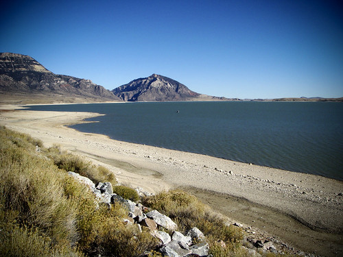
Named the Scenic Byway of Highway 20, aka the Wapiti Valley, the road is wedged into a valley shaped by the flow of the Shoshone River. The swath of wildness is charged with history and scenery. The Buffalo Bill Dam/Reservoir and Buffalo Bill State Park were worth the drive alone.

Buffalo Bill Reservoir, Cody, Wyoming

Buffalo Bill Reservoir

Nothing mechanical could capture what I saw with my own eyes. I didn’t try to create art from art, but rather to simply document I’d actually been there. Sometimes point and shoot is all you need do.  Things like this burn into your memory and you may forget when it happened but you never forget that it did.

DSC02769 copy

DSC02667 copy

DSC02848 B&W

The East entrance‘s ranger station was built in 1934 but visitors staying in Cody, Wyoming had been entering the Park for years prior (Yellowstone was designated a National Park in 1872).

Cody was established in 1896 by wild west showman, William F. Cody, “Buffalo Bill” along with a group of investors from Buffalo, New York and Sheridan, Wyoming. They realized the potential for tourism since Yellowstone was only 50 miles west. Burlington Northern Railroad reinforced (and rewarded) the tourism dream when they completed a line into Cody in 1901.

Instead of the railroad, I drove. The round trip of 100 miles to Yellowstone from Cody and back took 7 hours. That should tell you that either I drive really, really slow, or there was a lot to see. Given that I’ve had a speeding ticket in almost every state I’ve driven, the latter is the best guess.

These guys did their part to make sure no one was in a hurry.

east entrance bison

American Bison

For more information on Yellowstone, check out these links:

Yellowstone’s Original Entrance

Official Yellowstone National Park Site

Lodges of East Yellowstone

Buffalo Bill Cody Scenic Byway

** The East entrance closes from early November to sometime in April because of snow. Be sure to do your homework before heading there in the winter.

Join the Road Trip Revolution at the Solo Road Trip Facebook Fan Page, here.
Yellowstone National Park’s Original Entrance

Yellowstone’s original entrance in Gardiner, Montana, and the only one open year-round, is framed by the Roosevelt Arch.  While all the literature points out this entrance is the only one open all year, few state why. The annual snowfall in Gardiner approximates 30 inches, while the rest of the Park averages 150 to 400 inches, depending on elevation. And once entering the Park from Gardiner you’ll be met with closed roads during the winter over much of the Park.  So schedule a Snowcoach tour and do your homework if you’re planning to see Yellowstone during the winter (a highly recommended journey).

IMG_4757 copy

Dedicated in 1903 by President Theodore Roosevelt, who was already on vacation in the park when asked to lay the cornerstone, the arch is 50 feet high and made of locally quarried basalt — plentiful since Yellowstone sits atop one of the earth’s largest volcanic hot spots.

The arch was erected as the formal entrance to the Park in 1903 since most visitors arrived via the Northern Pacific Railroad’s nearby stop in Cinnabar, Montana. Stagecoaches made the remaining short trek to Gardiner. I cannot imagine arriving there by railroad. I cannot imagine arriving there by any means of transportation of the day.  The ground boils beneath you while the mountains always coddle snow on top. Were it not for modern climate control’s tempering of these extremes, conditions would be brutal most anytime of the year.

While the arch may be Gardiner’s claim to fame and really the only thing of note to see there, it’s worth a stroll to see some of the older parts of town. The Flying Pig Camp Store has internet access and bear pepper spray, an important combination you’ll see frequently in these parts. There’s plenty of lodging, restaurants, and outfitters so it’s a well stocked and not overrun base with which to explore Yellowstone.  Gardiner is 53 miles south of Livingston. Bozeman is 26 miles west of Livingston on Highway 90, providing the only airport in the area serviced by major airlines (most seasonal). Billings’ Logan International Airport (BIL) is 117 miles east of Livingston on Highway 90 and offers a much broader array of scheduled flights on major airlines.

Mammoth Hot Springs, 5 miles south of Gardiner is the Park’s headquarters and an eye opening welcome to the ancient, wild world of Yellowstone. From mid-April to early June, bison new-borns dot the ground. Bison is the correct scientific term for the North American species, but “buffalo” has become an accepted synonym.  In the seventeenth century, French explorers in North America referred to the new species they encountered as “les boeufs”, meaning oxen or beeves. The English arriving later, changed the pronunciation to “la buff”. The name grew distorted as “buffle”, “buffler”, “buffillo”, and, eventually, “buffalo”.

Yellowstone has the largest free-roaming bison herd in the world, estimated at 3,500 head.

IMG_4726 copy

Female bison’s gestation period approximates 9.5 months. Twins are extremely rare. At the turn of the 20th century the bison herd had been slaughtered from a high of 120 million to less than 30. Today they approximate 500,000. Bison are a ruminant similar to cattle, in that they chew their cud. They can weigh up to 2,200 pounds and run at speeds up to 40 mph. Talk about mass in motion!

IMG_4674 copy

Mammoth Hot Springs – all about extremes. Heat, water, limestone, and rock fracture combine to create terraces of travertine. The travertine is deposited as white rock, but microorganisms and living bacteria create beautiful shades of oranges, pinks, yellows, greens, and browns. The terraces are constantly changing.

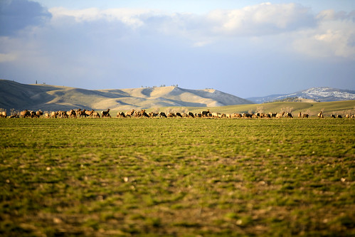
No discussion of Mammoth Hot Springs/Gardiner would be complete without a reference to the Elk that migrate in early fall when the weather cools off and they re-emerge from the coolness of higher elevations.   If you stay at the Mammoth Hot Springs Hotel, your day will begin and end with the eerie, wild sounds of male Elk bugling for the rut and a change of seasons. It’s a sound I recommend everyone hear once; it’s unforgettable.

IMG_4416 copy

Wapiti; not a petting zoo.

Yellowstone Map

Yellowstone Map

Join the Road Trip Revolution at the Solo Road Trip Facebook Fan Page, here.
 

The Grand Climb


Tammie DooleyAbout SRT... I’m a traveler, writer and photographer for whom the open road frequently summons. Adventurous solo road trips are a staple for me, and a curiosity. So I created this website to share them and inspire you to step out and give them a try. Welcome!

A soul that sees beauty may sometimes walk alone – Wolfgang Von Goethe

  • Categories


  •  

    Connect with SRT

    RSS Connect on Twitter Subscribe by Email
    Email me
    Become a SRT Facebook Fan
    Follow me on Twitter
    See my photos on Flickr

    I want to hear from you!
    ~ Tammie


    World Reviewer adventure travel blogs