SRT RSS Feed

Death Valley Sailing Stones

The fat on my forearm began to render immediately, the skin crackling and puckering, the hairs standing on end. Death Valley feels like one of those industrial heat lamps in a restaurant kitchen that will sear the skin of a human hand. 

As I got out of the air conditioned van the skin on my neck started crawling like it does when my husband blows on my poison ivy.  All of this happened before I could plunk on a hat and unroll my sleeves and the thought crossed my mind that given only a few more moments, my brain might have begun budging around by the slow rolling boil of the juices in my skull. 

People come from all over to experience the heat of Death Valley, because who doesn’t want their fat rendered? 

I prefer vegetation with my heat.  But nothing grows on the Playa. Nothing blooms, wilts, or dies because it never gains a start. Between the heat, lack of moisture, and the low elevation air pressure, the earth is compact and unmoving. There were a few shimmery silver mirages on the road. Everything else was white hot, not a glancing white hot, but a straight on, there’s no escape, Benjamin Moore Decorator’s White, blinding white. 

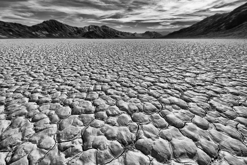
The ground temperature can be 80° F hotter than the surrounding air. The alternating hard-pack scabbed and pocked earth under your boots looks random, but it’s not. Geometrical hexagons of mud form that are 3-4 inches across and configure in sets of three at 120° to each other. So says the universal language of geometry. 

the hexagons of packed earth on the floor of Death Valley

Geometry of Death Valley’s Playa

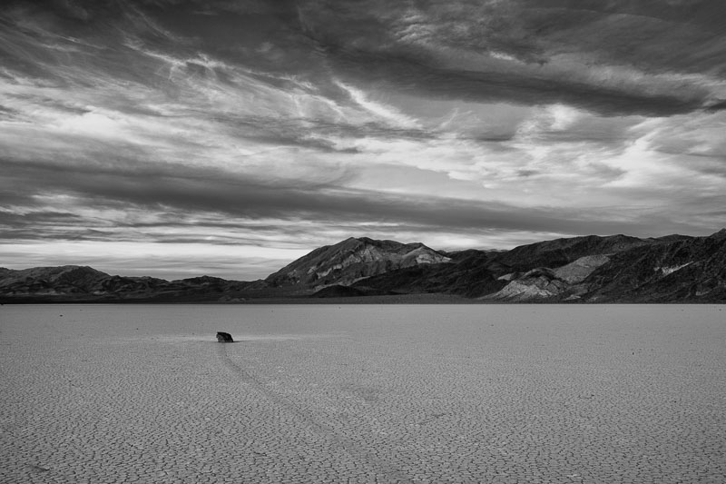
There may be an absence of plant life, but the sailing stones make up for the lack of greenery.

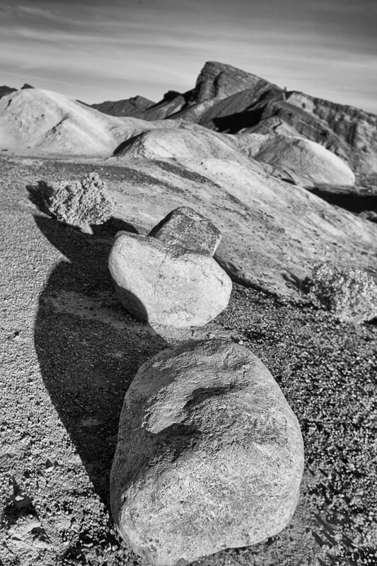
The sailing stones of Racetrack Playa are nocturnal.  Furthermore, they only move when no one’s looking.  Stones are the things you skip, or throw, or hide in a snowball. But some of these stones are hundreds of pounds, making them in my opinion, boulders. Aliens have been given the credit for this phenomenon and I can’t argue. I walked upon one and saw the skid marks fade into the distance and stood there for a long time as in observing a tennis match.  Scientists have claimed the explanation that the stones are awakened by a specific combination of natural events —  wind, an icing of water for a skid, and a fair amount of juju that no one fully understands and voilà, they move across the plain of the desert floor. 

Sailing Stone of Racetrack Playa in Death Valley

Racetrack Playa Sailing Stone


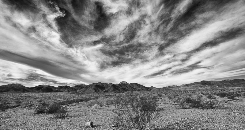
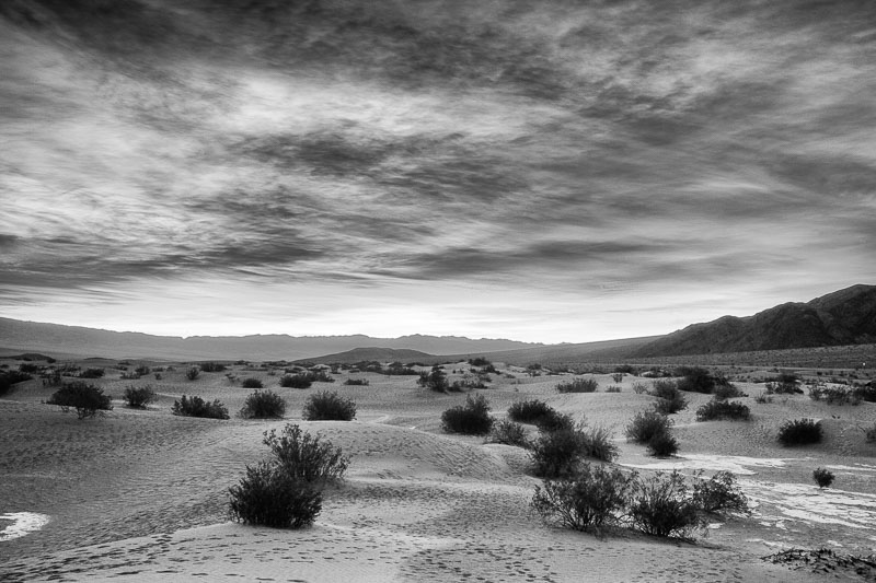
the starkness of Death Valley

Stark Beauty Defined


John Batdorff of Batdorff Photography in Chicago, and his wife Staci Prince offer this photography workshop.  If you’re interested in seeing parts of Death Valley that you won’t see on your own, you should go.  The instruction was one-on-one, and everything was top-notch.  They are a delight to travel with and learn from. It was a fantastic trip, and they have a knack for summoning exquisite sunrises and sunsets in a place that seldom experiences the moisture required for clouds.  Thank you John and Staci. 

Join the Road Trip Revolution at the Solo Road Trip Facebook Fan Page, here.


50 Things to-do in Jackson Hole & Grand Teton National Park


At some point every year, my thoughts turn to Jackson and the Tetons. A hunger to see them, breathe the mountain air, gaze upon the abundant wildlife, dine at my favorite restaurants, and hike favorite trails, inevitably starts to gnaw.  

Some can’t fathom traveling to the same place twice; there is indeed a great deal to see in the world. But even among those with the most severe case of wanderlust, many have a favorite destination – a place whose familiar embrace is longed for.

Jackson Hole, Wyoming is that place for me.  The wonder and enchantment of the mountains and the valley is constant. It’s the intrigue generated by the continual motion of rotating sensory stimulus that causes me to travel there again and again — it is never the same twice.

Grand Teton National Park and Jackson Hole overlap (one of only two airports in the United States in a National Park). I’ve broken the list down by what’s technically in the Park and what isn’t. With a map and this list, you’ll see some of the best the area has to offer.

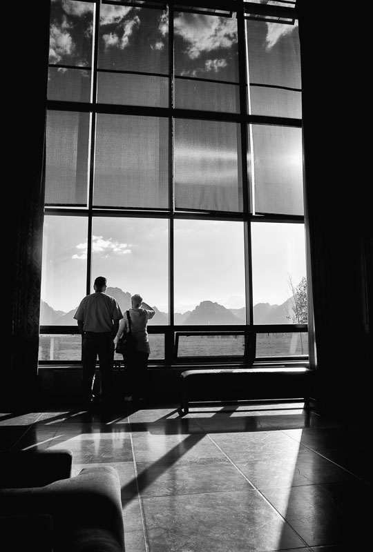
couple looking at the Tetons

The Tetons from Jackson Lake Lodge


Grand Teton National Park

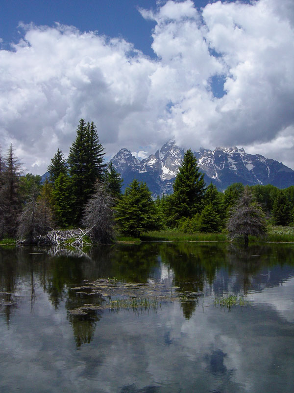
Schwabacher Landing


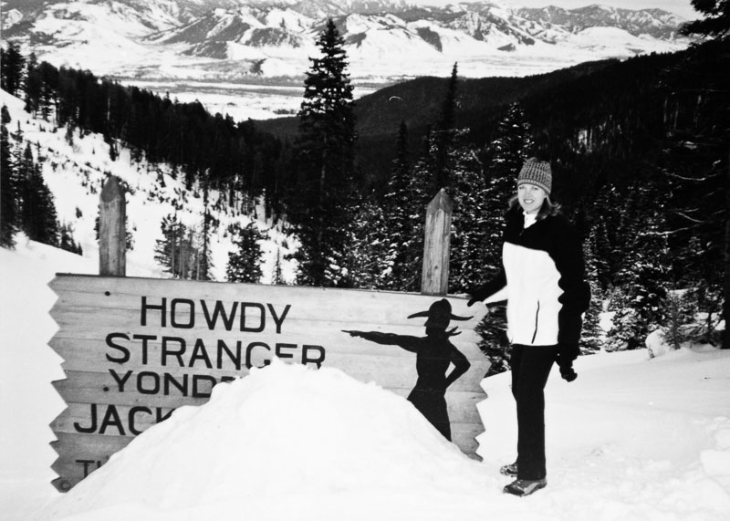
Teton Pass Sign in the winter

Lots of Snow

Teton Pass sign in the spring

Glorious Spring

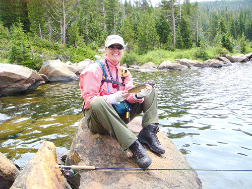
the author with a Wyoming Cutthroat

Wyoming Cutthroat

Grand Teton National Park

1. Walk through Jackson Lake Lodge. The wall of windows at the back facing the Teton Mountain Range frame a spectacular view. The wildlife watching at dusk from the outdoor patio at the back is fantastic. Highway 89/191 just north of Jackson Lake Dam.
2. Enjoy a meal on the patio at Signal Mountain Lodge – the PILE of memorable (based on size and taste) nachos and the tequila lime chicken quesadilla are a must. Add insult to injury and get the chocolate pecan bourbon pie to go and one of their palm-sized homemade cookies at the checkout counter.
3. Since you’re already there, drive to the top of Signal Mountain. Teton Park Road south end of Jackson Lake. And yes, you CAN drive to the top.
4. Take the boat across Jenny Lake and walk up to Inspiration Point/Hidden Falls. Teton Park Road.
5. Take a hike. There are many from which to choose and for all fitness levels. From the Taggart Lake hike of 4 miles to the all day not-for-the-faint-of-heart Amphitheatre Hike (rated very strenuous), there’s something for everyone. Taggart Trailhead – Teton Park Road just north of the Moose Entrance gate; Amphitheatre Trailhead – Teton Park Road, Lupine Meadows, north of Taggart trailhead and south of Jenny Lake.
6. Drive to Antelope Flats for wildlife viewing. Road turns East off of Highway 89/191 just north of Moose Junction. Watch for a sign.
7. See the barns on Mormon Row for a classic view of the Tetons. 13 miles north of Jackson on 89/191, go east at the Gros Ventre Road turnoff, then head north on the first road that junctions. Mormon Row is in the southern area of Antelope Flats.
8. For scenery and wildlife viewing, find Schwabacher’s Landing. It’s a photographer’s dream. Highway 89/191 north of Moose Junction.
9. The same goes for Oxbow Bend. Highway 89/191 north of Moran Entrance Station and south of Jackson Lake Junction.
10. Find the spot where the 1953 Western film, Shane, was filmed (towards Kelly).
11. See the Gros Ventre (Grow Vaunt) Slide Geological Area. On June 23, 1925, 50 million cubic yards slid off the side of Sheep Mountain damming the Gros Ventre River and creating Lower Slide Lake. Highway 89/191 just north of Jackson and south of the airport, turn East onto the Gros Ventre Road. Follow the paved road past Kelly.
12. Stand in awe at the Snake River overlook made famous by Ansel Adams. Highway 89/191 north of Schwabacher’s Landing, south of Triangle X Ranch (all marked).
13. Locate the Old Patriarch Tree (about a 15 minute walk off the road). 89/191 north of Moose Junction. If you want the GPS coordinates, you’ll have to leave a comment and ask me for those!  
14. Stay at a dude ranch. Any dude ranch.
15. Take a horseback ride. Anywhere.

This one is too spectacular to be relegated to a numbered list – climb Grand Teton.  

the author at Grand Teton Base Camp

Grand Teton Base Camp

Jackson Hole Area

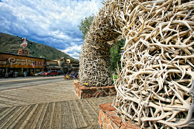
Downtown Jackson Hole

Antler Arches

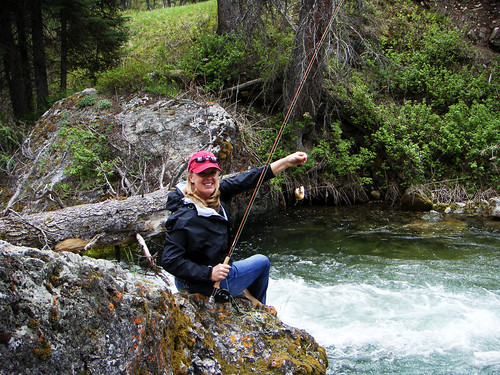
Big Smile, Tiny Cutthroat Trout

Big Smile, Tiny Cutthroat

snake river overlook B&W film

Snake River Overlook


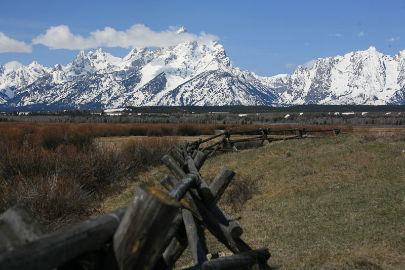
a view of the snow covered Tetons

Postcard View

16. Get pictures at the top of Teton Pass (8,341 feet), in front of the famous Teton Pass sign with the cowboy pointing towards Jackson Hole (especially fun during the winter when the snow covers most of the sign). Approximately 11 miles west of Jackson on Highway 22 and just up the mountain from Wilson.
17. Speaking of Wilson: grab a cappuccino and bagel at Pearl Street Bagels (my fav? everything bagel with sundried tomato, olive oil cream cheese + an oatmeal craisin cookie) and eat it on the picnic table just out back.  There’s also a Pearl Street Bagels in the town of Jackson but it lacks something (even though the food is just as good) compared to the Wilson location.  Also in Wilson, eat at Nora’s Fish Creek Inn. Get a soda pop at the General Store.
18. See the National Museum of Wildlife Art. Just north of Jackson on 89/191. Be sure to check out the gift shop.
19. Drive to the Curtis Canyon Overlook. In Jackson behind the hospital, take the Elk Refuge Road. It’s a dirt road that makes a forced turn to the north – after that change of direction, take the first road east. Wind your way into the backcountry until you see the sign and the overlook. Great place. I once photographed an eclipse from there. And big horn sheep.
20. If you know how to flyfish, then wet a line here. If not, take a lesson or a guided trip. Check out Jack Dennis (now Grand Teton Flyfishing) or several other flyshops for their offerings.
21. Take a drive on the Moose-Wilson road. Make sure you have binoculars for the wildlife. North of the airport on 89/191, take the Moose Junction exit. Before you get to the Grand Teton National Park gate, you’ll see a sign for the road on your left.
22. Wine tasting at Dornan’s; pizza at Dornan’s; cookies at Dornan’s (inside the grocery shop). North of airport on 89/191, take the Moose Junction exit. Dornan’s has a sign just past the turnoff.
23. Raft down the Snake River (through the Canyon). Several outfitters to choose from.
24. Chicken pizza at the Brew Pub (Snake River Brewery – downtown Jackson). Any beer at the Brew Pub – micro brewed on the premises.
25. Try on and or have made an authentic, beaver fur, cowboy hat at Sing Hat Company.  Christy Sing crafts works of art for the head. 
26. Stay at Wyoming Inn, or the Four Seasons, or the Snake River Lodge & Spa, or the Wort Hotel.
27. Try Pica’s Mexican Taqueria restaurant near Albertsons in downtown Jackson. There’s a florist and a few other shops next to them. They have great Mexican food, terrific margaritas. The fish tacos are my favs.
28. Breakfast at Bubba’s – biscuits and gravy, pancakes – best I’ve ever had!! Great omelets.
29. Any meal or snack at The Bunnery (downtown Jackson)
30. The Blue Lion Restaurant! Have the stuffed mushrooms as an appetizer and the lamb shank for an entree (downtown Jackson).
31. Dinner & oyster shooters at the The Rendezvous Bistro. My husband loves the green oyster shooters, I love the red ones. Try both. (South of downtown Jackson)
32. Massage at the Rusty Parrot Lodge (downtown Jackson)
33. Take in one of the many festivals. The Fall Arts Festival is in September. Film Festival in September/October. Music Festival in July and August. 
34. Persephone Bakery.  7:00 am – 6:00 pm.  Picnic (smoked salmon and cucumber toast).  7:00 am – 3:00 pm. 
35. Shop at Skinny Skis and Teton Mountaineering in downtown Jackson – my two favorite shopping excursions in the world (go up the stairs in Teton Mountaineering and you’ll find their sale items).
36. Walk inside Atelier Ortega’s chocolate shop, then try to walk out empty-handed. Or the dessert boutique, CocoLove.  Chef Oscar Ortega is a Master Chocolatier. 
37. For fun, unique, home interior shopping, Stockton & Shirk.
38. Shop at The Bootlegger in downtown Jackson.
39. Take a sleigh ride on Elk Refuge in winter.
40. Order an Arnold Palmer wherever you eat (it’s a tea/lemonade mix and very Jackson).
41. Tram ride to the top of the Teton Village mountain (Rendezvous Mountain) and hike down, or NOT.
42. Enjoy lunch or simply a walk through at Teton Village’s Mangy Moose Restaurant. The Idaho trout fish and chips are memorable as is the full sized stuffed moose hitched to a sleigh hanging from the ceiling.
43. Dinner at the Bar J Chuckwagon on Highway 22 (on the way to Teton Village). You’ll get a real chuckwagon meal (fit for a king), a wagon ride, and a cowboy music show.
44. Hike to the top of Snow King (ski mountain in downtown Jackson) and if you can’t do that, take the ski lift – GREAT aerial view of Jackson.
45. Hike up High School Butte and watch the handgliders take off.
46. Find the Sleeping Indian (hint: Sheep Mountain).
47. Find the town square’s live webcam and wave to friends at home (stand on the corner near the stagecoach office and wave to the cam on top of Jackson Trading Company); sit in the town square, admire the elk horn arches (all naturally shed), and people watch.
48. Attend the Shootout every summer evening at 6:00 p.m. (downtown Jackson) and ride in a stagecoach. 
49. Find an art gallery brochure and take a self-guided tour around the galleries located on the Jackson town square.
50. Attend a rodeo.

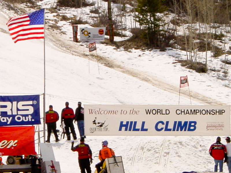
Jackson Hole Hill Climb

51.  BONUS!  Attend the World Championship Hill Climb (snow mobile stunts — great fun).


Join the Road Trip Revolution at the Solo Road Trip Facebook Fan Page, here.


Hard Life


The Black Hills: 25 Memorable Sights

This Great American Drive will compel you to sing the Stars & Stripes and purchase a long, black duster.  Be prepared.

The Black Hills (Pahá Sápa in Lakota) are an isolated mountain range rising from the Great Plains of North America in western South Dakota. The range extends into Wyoming.  The hills are covered in trees, an effect that gives them a darkened appearance from a distance. The dusky corner was distinctive enough to garner the name “black hills.”

The grandeur of granite rising from the cliffs of Mt. Rushmore will in one upward glance sweep away any countryman’s negative sentiments. And impress the hell out of everyone else.  Mt. Rushmore is but one impressive sight however, among the many packed into South Dakota’s southwestern corner.
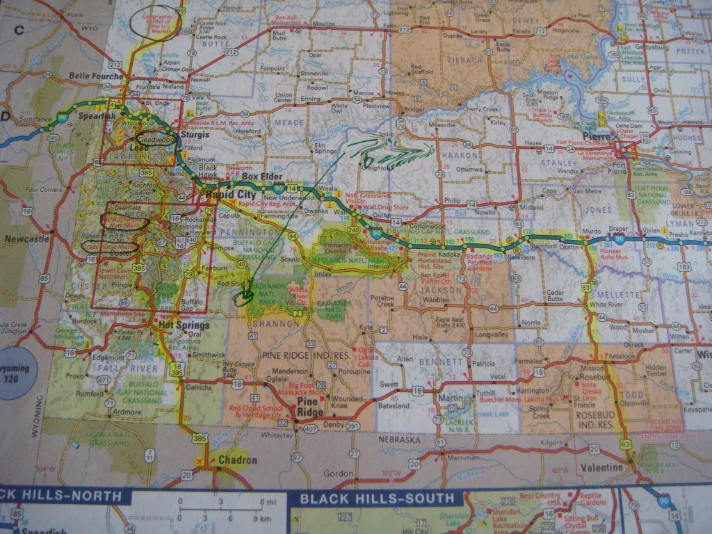
map of Black Hills South Dakota

Atlas Map of the Black Hills Area


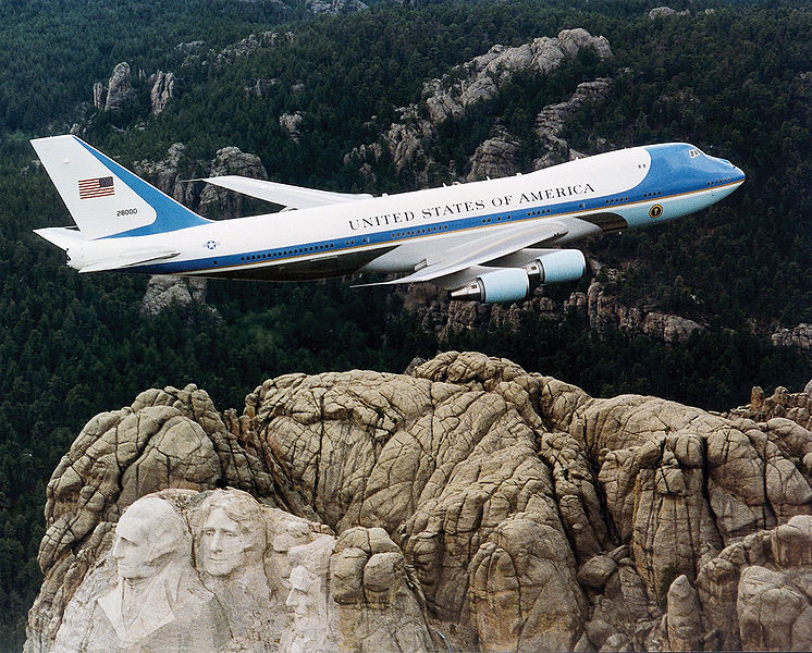
Air Force One over Mt. Rushmore. Wikimedia Creative Commons.
Air Force One over Mt. Rushmore. Wikimedia Creative Commons.


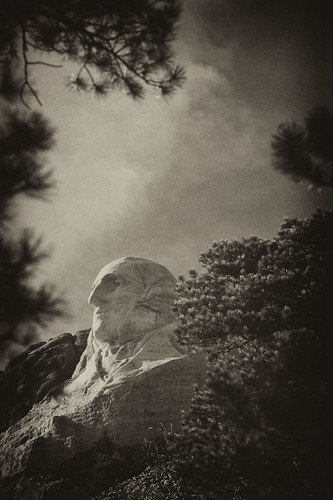
George Washington, Mt Rushmore

George Washington, Mt Rushmore


The Black Hills

Anchored by Rapid City (airport code RAP), the Black Hills area still echoes with the report of Wild West Colt pistols. You can wander through Native American Indian Reservations as you contemplate what to take in first — the sights of Mt. Rushmore featured on the big screen in National Treasure: Book of Secrets, the cavernous limestone formations of Badlands National Park, Sturgis or the frontier town of Deadwood. Throw in the Crazy Horse MemorialCuster State ParkWind Cave National Park, the 1880 TrainBuffalo Gap National Grassland, the Geographic Center of the U.S., the Minuteman Missile National Historic Site, Jewel Cave National Monument, or the Mammoth Site, and a week’s vacation can be easily spent in one of the most scenic and pivotal historic areas of the lower 48 states. And that’s before you even cross into Wyoming.

Forget the guidebook, you’ll need only your Atlas and a penchant for discovery.
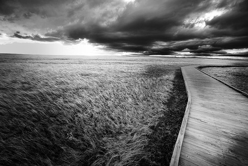
 

boardwalk in the Badlands

Badlands, South Dakota — Tammie Dooley all rights reserved.

The Route: starting in Rapid City

Interstate 90 East of Rapid City will deliver you to Wall, South Dakota. If you’re already parched or ready for a stop, the Wall Drug Store offers refreshment, take in the National Grasslands Visitor Center, or search for the Minuteman Missile Silo.  From there 240 South will take you directly to the scenic drive around the North Unit of Badlands National Park. The loop ends at Interior. To continue into the South Unit’s 2.7 million acres of sprawling erosion of the Pine Ridge Indian Reservation, proceed past Imlay to Scenic, turning South at the first/only turnoff. You’ll need to stop at the White River Visitor Center to get permission to proceed into the Reservation. West on Highway 2, then North on Highway 40 to Redshirt will complete the South Unit.

“Highway” 2 is a misnomer. The road is gravel, albeit wide and well maintained. Continuing past Redshirt on Highway 40 to Hermosa presents the choice of turning North on Highway 79 and back to Rapid City, or west on Highway 36 to 87 South to Custer State Park and Wind Cave National Park. From Wind Cave National Park you can easily hit 385 North taking you to Custer, the Crazy Horse Memorial, Mt. Rushmore, and the ‘1880 Train’ in Hill, as you progress northward.

Pine Ridge Indian Reservation

Pine Ridge Indian Reservation

Plains Indian Burial Platform

The area is deceptively compact.  While distances aren’t great between any point (from Rapid City to Hot Springs on 79 is only 57 miles) you will not desire to cover any of it quickly.  And the twists and turns of the roads preclude speed.  While limited lodging is available in the smaller towns and in Badlands National Park, the high season summer months make day trips to and from your pre-reserved lodging in centrally located Rapid City conducive to combing the area.

Deadwood

Once you’ve exhausted the sights south of Rapid City, 385 will take you to Lead (as in lead a horse to water), Deadwood, the Geographic Center of the U.S. in Belle Fourche, and Sturgis to the East just off Highway 90.  Either of these towns is worthy of securing lodging if you’re ready to venture past the Rapid City anchor.  Summer is high season and Sturgis, along with towns in the area are choked with bikers for the annual Bike Week Rally the first week in August.

Deadwood is a personal favorite (fall only, please). Wild Bill and Calamity Jane are buried in the Mt. Moriah cemetery. Saloon 10 is where Wild Bill made famous the Dead Man’s poker hand of Aces & Eights when shot from behind by Jack McCall (hanged for his crime). The town, while a haven for gambling is replete with history and the nostalgic charm of false storefronts.
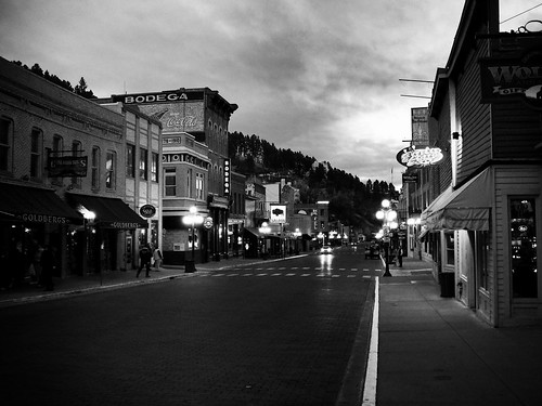
Main Street, Deadwood, South Dakota

Deadwood, South Dakota

Regarding FOOD, if you’ve got a nose for chocolate on the road, stop by The Chubby Chipmunk for a fix. 

For lunch, try Maverick’s. For dinner, Legends Steakhouse in the Franklin Hotel.  While gaming seems to be steady, the restaurants in Deadwood have turnover.  I’ve not eaten at either of these establishments, but Tripadvisor has both of these at the top of the list. Sadly, my favorites have closed since the last time I was in the area.  

A Wyoming Detour: Devil’s Tower

Since you’re on the border and you could add another state-notch to your holster belt, why not venture into Wyoming? Devil’s Tower National Monument is a quick drive and well worth the time. Take Highway 90 to Sundance, Wyoming. From there head north on 14 for a few miles. Or if you’re sticking to the backroads, Highway 34 west out of Belle Fourche (turns into 24 at the Wyoming border) will get you there as well.  Should you venture here during the off-season, don’t count on lodging nearby. There IS lodging, but…

Devil's Tower National Monument, Wyoming

Devil’s Tower, Wyoming

President Theodore Roosevelt Proclaimed Devil’s Tower the first National Monument in 1906. Many Plains Indians have legends associated with “Bear’s Lodge” and consider it a sacred site. The Kiowas legend is that several families were camped by a stream where there were lots of bears. Seven little girls were playing away from their village and bears took chase. The girls ran and just as the bears were about to catch them, they jumped on a low rock. One of the girls began to pray. The rock began to push itself out of the ground raising the children higher and higher. The bears clawing their way to the top made the deep grooves. The rock continued to push the children upward into the sky so far they reside in the sky today as the pleiades star cluster.


WARNING: If you decide to venture out of Belle Fourche to locate the original Geographic Center of the U.S. or anywhere in the above discussed areas, BEWARE of Rattlesnakes.

Join the Road Trip Revolution at the Solo Road Trip Facebook Fan Page, here.


The Tetons from a Dog-Trot Cabin

Standing in the breezeway of the settler’s dog-trot cabin, the sod roof sheds sandy sparks when the wind rises. Moisture from the dirt floor has been trawled by a broom so many times, it’s glossy in spots. And cold and hard as concrete.

The single window of the home lopsidedly frames the massive Tetons. To enjoy the view straight-on it’s necessary to kneel beneath the low ceiling. On my knees to photograph the scene, the cold seeps through my jeans. The sharp, snow covered crags cause my eyes to glance away for the softer bits of stray light coming through the gaps in the lodgepole pine logs. A powerful stroke of wind puffs the heavy snow into swirls covering the upper peaks of the mountains. It quickly chases down the cabin. Pulling my coat tighter around me, a few steps land me back in the warmth of the May sun.

Dog-Trot Cabin

Standing at the back of the cabin, the ancient panoptic beauty of these mountains rivets my attention and the discomfort of the chill is momentarily forgotten. The next blast of air turns my head back to the cabin. There, in between the pioneer’s only separation from the elements and the view of which I can never get enough, their struggle comes to life.

The truth is one of the most photographed, most photogenic scenes in America was of little consolation in the isolation of the brutal environment.

Hard Work

According to the Homestead Act of 1862, five years of residence on the property along with cultivation of the land was required to call it your own. The problem was, well, there were a lot of problems.

The ability to cultivate had to be arrived at. With only 60 days of a frost free growing season, limited access to water, and land choked with willows and aspen brush, many pioneers managed to clear less than 20 acres during the 5 year term.

From a final testimony of proof:

1911 2 acres veg. cattle got it.
1912 3 acres ½ acre veg. 1 ton.
1913 No crop
1914 No crop too dry.
1915 3 acres cattle got it.
1916 3 acres 1 a.veg. ¼ ton veg.

Six years of body battering labor shared in a cursive 30 word preemption document, entitled a settler to 160 acres in Jackson Hole, Wyoming in 1918.

His work had just begun.

Join the Road Trip Revolution at the Solo Road Trip Facebook Fan Page, here.
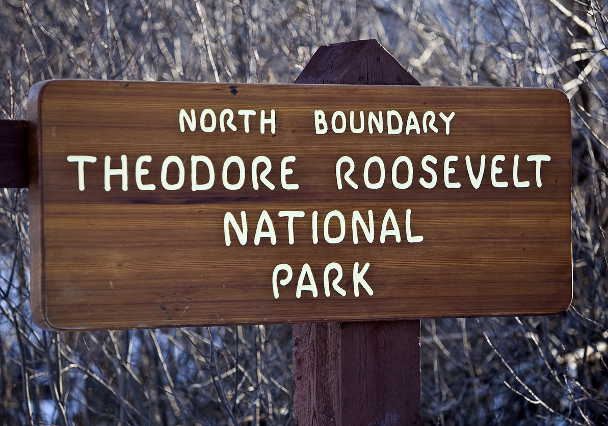
Theodore Roosevelt National Park

Medora

Theodore Roosevelt National Park

The plan from the start was to see North Dakota from end to end. Entering the state on its far western border from Highway 85 (two hours later than planned) because of the hunt for the Geographic Center of the U.S., I’m tempted to call it a day. Snowfall in the Western part of the state has been unusually heavy over the 2008-2009 winter, meaning road conditions demand attention.

But not enough to override the recognition night is about to throw its protective cover.  And with that dimming comes glorious shadows, wildlife stirrings, sunset kaleidescopes, and the overall suspense that lovely, unexpected things happen when the light wanes. Joy spreads through my tired limbs leaving no room for thoughts of the creature comforts of a motel room. I drive into T.R. National Park.

Theodore Roosevelt became the nation’s 26th President in 1901. He said “I would not have been President had it not been for my experience in North Dakota.”  The Park includes Roosevelt’s Elkhorn Ranch and was designated a National MEMORIAL Park in 1947. It didn’t achieve full National Park status until Jimmy Carter gave the approval in 1978.

IMG_1179

Mule Deer

Theodore Roosevelt National Park

See what I mean about lovely surprises?


The Grand Climb


Tammie DooleyAbout SRT... I’m a traveler, writer and photographer for whom the open road frequently summons. Adventurous solo road trips are a staple for me, and a curiosity. So I created this website to share them and inspire you to step out and give them a try. Welcome!

A soul that sees beauty may sometimes walk alone – Wolfgang Von Goethe

  • Categories


  •  

    Connect with SRT

    RSS Connect on Twitter Subscribe by Email
    Email me
    Become a SRT Facebook Fan
    Follow me on Twitter
    See my photos on Flickr

    I want to hear from you!
    ~ Tammie


    World Reviewer adventure travel blogs